The GE Coords program simplifies the job of grabbing coordinates for a point in Google Earth, and putting them into your clipboard, from where you can paste them into the application of your choice. Not terribly complicated to use (and the website has more complete instructions if you need them):
1. Install the program (you’ll find it in the “Thots Utilities” folder)
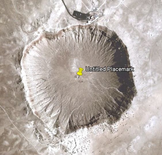
2. Fire up Google Earth, press the yellow pushpin icon on the toolbar, and drag it to your desired location:

3. After closing the placemark properties box, right-click on the pushpin and select “Copy” from the drop-down; this will copy the full KML code for the placemark into the clipboard
4. Run the GE Coords program; it parses the KML code, extracts the position, and copies the coordinates into the clipboard. You’ll hear a beep when it’s done. DM is the default format:
N 35° 01.640 W 111° 01.364
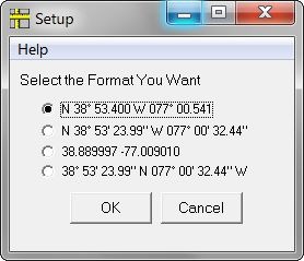
But running the program without any placemark code in the clipboard brings up the option to “Setup” the desired default coordinate format:

Thanks for another helpful post. It reminds me of the earlier “Importing Google Earth Imagery Into A GIS” thread: going back to that, I was interested in finding a GE utility that would report the corner coordinates of the current GE view (x-max, x-min, y-max, y-min), with which to calculate the parameters for a world file (.jgw) to accompany a GE image-save. Or even better, a utility that grabs the coordinates and writes the world file itself – that would be brilliant. It would need to know the resolution (x-pixels by y-pixels) at which the image was saved, but that is easy enough to type in or even to get directly from the JPG. But I haven’t come across any way to programmatically find the edge coords in GE. Any ideas?
am I missing something?
Can’t you just drop a pin in GE and then right click it, click properties and then copy the DD coords from there?
Saves installing another piece of software.
Absolutely you can do that. But you’ll have to select the latitude/longitude coordinates individually, then switch back and forth twice to paste them separately into your app. I think the GECoords approach is marginally faster and more convenient, plus you have the option of setting the coordinate format you’re pasting in. But it’s obviously not going to be a huge savings in time. Your choice …
The post you reference described using the program shape2earth to do exactly what you want, create a worldfile for a Google Earth image capture. The program Mobile Atlas Creator, which I covered last week, can create a Google Earth/Maps imagery composite in OziExplorer format; if you have a program like GlobalMapper which can import this format, and then export it in GeoTiff or similar format, that should work as well. But you need to read the TOS/EULA for Google Earth carefully to see if your application falls under “fair use”; given how much I got beaten up about that topic after the last post, I’m not going to touch that again. However, Mobile Atlas Creator can generate OziExplorer imagery files for MS Virtual Earth / Bing Maps imagery, and I believe the TOS/EULA for that is somewhat looser than Google’s. Ask your lawyer :).
Yes, shape2earth does indeed do the job nicely, although the pixel size it defines in the world file seems to assume that the GE image save is done in GE standard version; in other words, it doesn’t work for image saves done in GE Pro (up to 4800 x 4800 pixels). Anyway, your suggestion of Mobile Atlas Creator sounds good – I’ll have a look now, thanks.
on http://www.gpsies.com/coordinate.do there is a way to use gpx date with a google map.
use “helper for map calibration.
you could try gpsmapedit , it can’t axport the google map but can make coordinates.
guido
Do you copy coordinates very often? Do you really need special program?
Click properties and then copy the coordinates.