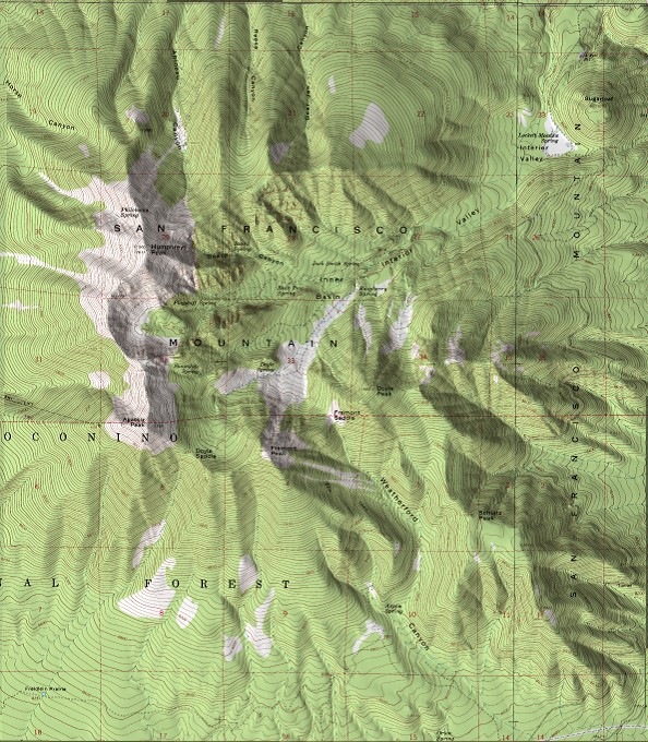
While good shaded relief is still a cartographic art (see the Shaded Relief and Relief Shading websites for more info), programs like 3DEM, MicroDEM and others can create decent shaded relief effects using digital elevation models (DEM) to shade raster graphic files. Here’s a sample USGS topo map shaded using 3DEM:

Another style of relief shading is scree shading, also called Swiss-style; it involves drawing small dots representing rocks on maps to provide texturing. In the past, there’s been no way to automate this process, so the only way to do it was by hand, a slow and time-consuming process. Bernhard Jenny of the Swiss ETH has recently introduced Scree Painter, a Java program (Windows, Mac and Linux) that, while not exactly fully automating the process or making it simple, at least makes it far more practical. Mandatory data required includes:
- A mask to define the size of stones (raster grayscale image with worldfile); darker areas will have larger stones
- A DEM (ESRI ASCII Grid format) to define gullies
- Shapefile polygons to define where scree stones will be placed
- A raster obstacle mask (with worldfile) where black defines areas where no stones will be placed; sometimes this can be the main raster map image
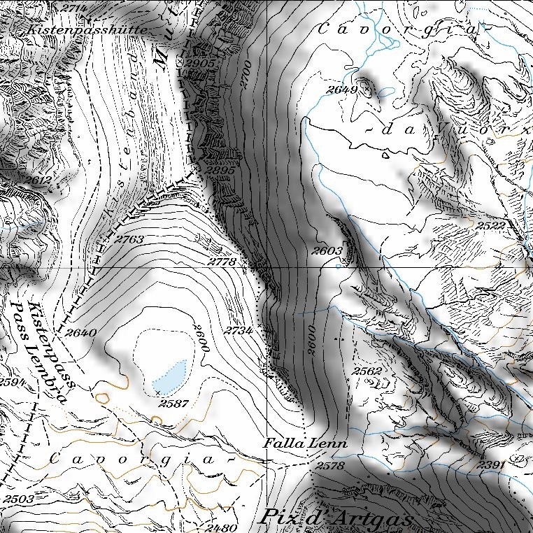
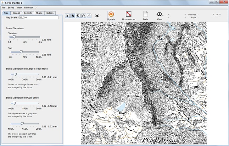
Optional data includes gully lines, a background reference image, and gradation and large stones masks. Once the data is loaded in, sliders let you vary parameters that change the density, shading and shadowing of stones. You can download a sample dataset to play with from the website. Here’s the original map:

Using a shaded relief program, I could convert this into:

But by loading it into Scree Painter, and randomly selecting some parameters, I can get this:

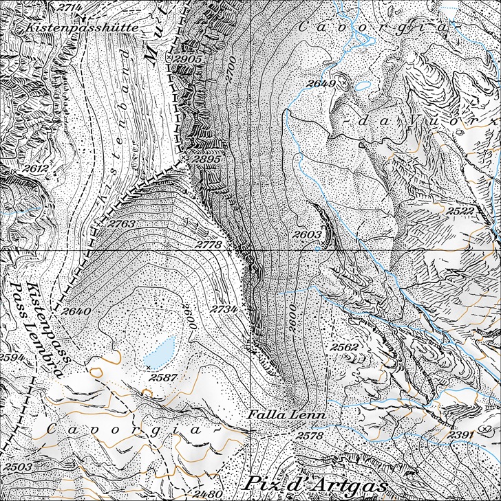
Not every good, but then I didn’t try very hard. The sample data includes a reference image that shows what the program is capable of:

Unfortunately, it doesn’t appear as though you can export the full original map with generated scree and gullies directly. You can export the scree and gully data in a variety of vector and raster format, but you then have to re-combine this data with the original map using a GIS or graphics program to get a result that looks like the one above. Hopefully the author will add the option to export the full image in a georeferenced format in the future.
Another open-source SW that can do shaded relief and relief contours (in combination with OSM data): http://igorbrejc.net/openstreetmap/making-my-own-hiking-map-with-kosmos