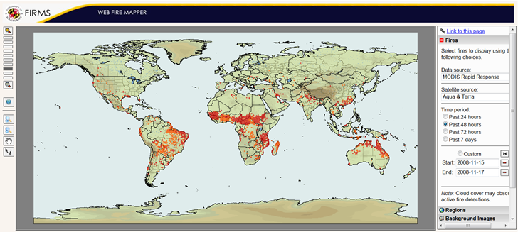
A timely data resource given the recent wildfires in California, the Web Fire Mapper plots the locations of fires across the globe as determined by measurements from the Aqua/Terra earth observation satellites:

- Plot fires as seen by Aqua, Terra, or both, using MODIS (Moderate Resolution Imaging Spectroradiometer) observations
- Choose a pre-selecting time period, or enter your own start/end times
- Choose the background image: Blue Marble, Elevations and Rivers (as above), or None (just country outlines)
- Enable additional layers: Administrative Boundaries (e.g. states), Cities and Protected Areas
- The Download function isn’t working yet, but includes a link to a page where you can download GIS shapefile data for fires over the last 48 hours or last 7 days
- If you create a view you like, click on “Link to this page” to create a bookmarkable link that saves those settings
There’s also http://firelocator.net/ which I just discovered yesterday .. with my former job being in WildfireGIS – this type of stuff really catches my eye ;)
Also a wildland fire GISS.
Try this one. http://www.firedetect.noaa.gov/viewer.htm