blankblank blank


Archive for the 'Web apps' Category Page 8 of 10


Downloading MapQuest, Live Search Results To A Garmin GPS

A while ago, I covered the process of downloading a Google Maps search result to a Garmin GPS, using the Garmin communicator plugin. The Garmin blog has posted videos on how to do the same thing with Microsoft Live Search:

MapQuest:


and Google Maps as well:


You will need to have downloaded and installed the Garmin Communicator plugin first; versions are available for both PC and Mac.


Online Traveling Salesman Problem Solver

Wikipedia defines the “Traveling Salesman Problem” this way:

given a number of cities and the costs of travelling from any city to any other city, what is the least-cost round-trip route that visits each city exactly once and then returns to the starting city?

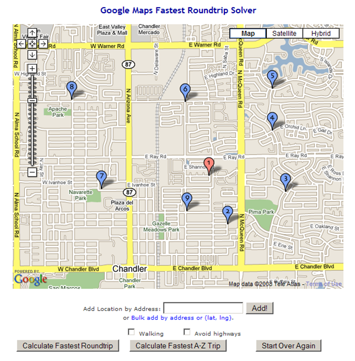
You can substitute “address” for “city”, making this an intra-urban travel problem. The OptiMap website solves this problem automatically for up to 24 locations (“nodes”). You can enter the nodes by clicking in a Google Maps interface:
12-1-2008-7.25.50 PM

You can also enter address nodes individually using the “Add Location By Address” box. Even better, you can add text lists of addresses or coordinates (latitude/longitude) by clicking on the “Bulk add by address or (lat, lng).” link, then copying and pasting the list into the text box that shows up. Latitude/longitude should be in decimal format, one set on each line, separated by commas and surrounded by parentheses, e.g. (35.333, –110.254). You can also specify only walking directions, and avoiding highways. The first node or address entered is always considered to be the starting point.

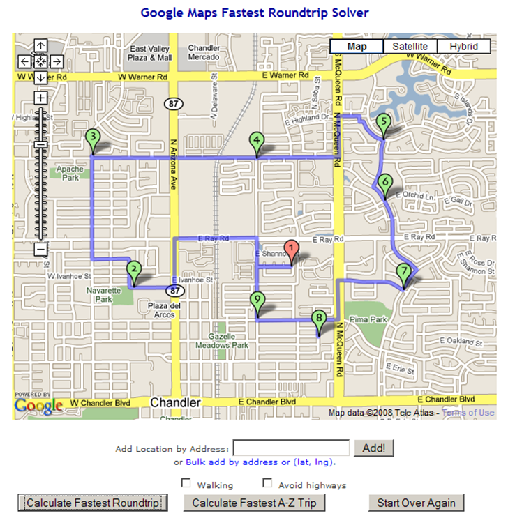
When you’re done entering nodes, click on “Calculate Fastest Roundtrip” to solve the problem for a round-trip that ends where you started:
12-1-2008-7.26.28 PM

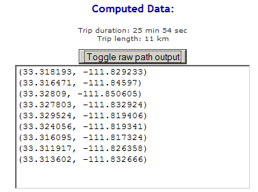
You’ll also get a set of Google Maps driving directions for the trip shown in the solution map. By clicking on the “Toggle raw path output” button, you’ll also get a text list of latitude/longitude coordinates in sequence for this route that you could convert into a GPS route:
12-1-2008-7.32.31 PM

The “Calculate Fastest A-Z Trip” works in a similar fashion, but for a one-way trip, where the first address/node you entered is taken as the start “A”, and the last address/node is the destination “Z”.

The technical background and source code are available on the OptiMap website, as are instructions on how to use this on your own website.



Create Your Own Gapminder Animated Charts

Gapminder is a flash-based tool for creating animated charts based on various parameters and indicators, including geographic areas. Here’s a TED talk showing examples of uses by its developer, Hans Rosling:

Up until recently, you could look at Gapminder charts for specific datasets at the website, but not create your own. Google, which bought the Gapminder technology in 2007, recently released a Google Gadget that lets you create your own Gapminder charts that can be embedded in a web page. You’ll need a Google Docs account, and also need to add the “Motion Chart” gadget from this web page. Once added, it can be accessed from the charts/gadgets button in a Google docs spreadsheet.


Plot Gazetteer Features In A Google Maps Interface

Gazetteers are listings of the names, types, and coordinates of both natural and man-made objects. For the US, the US Geological Survey’s Geographical Names Information Service (GNIS) contains name, feature type and position information for over two million geographic features in the US. Feature classes include both man-made (populated place, bridge, canal, etc.) as well as natural features (arch, spring, arroyo, woods). There are a number of similar databases for the rest of the world, like the NGA’s GNS Server, and the GeoNames site.

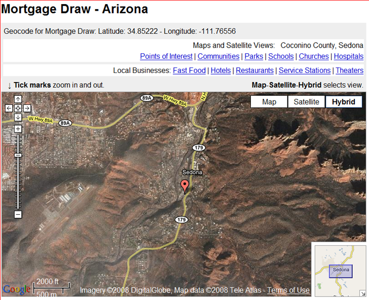
Another gazetteer website worth a look is SatelliteViews.Net. For geographical subdivisions, they have the US broken down by state, and the rest of the world by country. Select a state or country, then select the type of geographical feature you’re looking for, and get an alphabetical listing of them for that particular region. Select a specific feature, and you’ll get both the coordinates and a Google Maps display with the feature location plotted.

snapper1210892116159

They claim to have 5.9 million worldwide geographic features indexed and linked.

Hat tip to Coy0tea (JG).


Simple Online Form For Creating An Embeddable Google Map

GEarthHacks has a new online tool called YourMap that simplifies the job of creating embeddable Google Maps. Enter the name, address (or lat/long), zoom level, desired map dimensions, and other information into an online form, and YourMap automatically generates the code to embed it in your website; you don’t even need your own Google Maps API key. Here’s an example for a great hole-in-the-wall Thai restaurant in Flagstaff, AZ:

View in Google EarthDownload Google Earth
Powered by YourMap from Google Earth Hacks.

Via All Points Blog.

Addendum: Just noticed that the location plotted above for the restaurant about 500 yards south of the actual location. Double-checked the address used for geocoding, and it was entered correctly, so you may want to check the results of YourMap’s geocoder to make sure it’s right.


Clickable World Climate Map

The World Weather Map lets you click on a location, and get a plot by month of temperature (max/average/min), rainfall, and average number of hours of sunshine. A fourth tab supposedly gives you “Experiences”, a link list of things to do at that location, but the list sometimes includes activities a long distance (> 100 miles) from that location. You can also add an overlay showing what areas are “Hot”, “Warm” or “Wet” for a particular month.

The main website’s map is also flawed in that there’s no zoom feature, so for areas where the climate can change dramatically over a short distance (like the American Southwest), getting the climate for the exact location you want can be difficult to impossible. (1/24/2008: Fixed by the good folks at WorldReviewer; see the comment below) Oddly enough, there’s a widget version of this map that does include a zoom feature, and which can be embedded in any website, as below. Click and drag to move the map; click on +/- to zoom in and out; click on any point to get the climate data for that location:

For more specific climate data, downloadable for any location on the Earth, try some of the applications described in this post. Via GoogleMapsMania.


Quick Zip Code Information

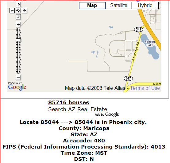
From the comments to my post on Mapping Zip And Area Code Boundaries comes a link to another, simpler site: ZipCodesMapped.Com. Type in a zip code, and get back the approximate location, area code, FIPS code, and timezone, along with a Google Maps window for the approximate area covered:

zipcode

The Google Maps window isn’t always 100% accurate – the example above is for my old neighborhood, and the displayed map doesn’t cover the entire area (though it is close). While it has less information than the USNaviguide website described in the original post, for quick lookups ZipCodesMapped.Com may be more convenient to use.


Mapping Zip And Area Code Boundaries, And More

The USNaviguide website has an assortment of Google-Maps-based services for mapping the boundaries of various geographic parameters:

Zip Code: Enter a 5-digit zip code, or the first three digits of a zip code, and get a map of the area covered by that zip code. Or click on the map, and get a map of the all the zip codes in that area, with a placemark at the location you clicked on with the zip code for that area in the info bubble:

clickzips

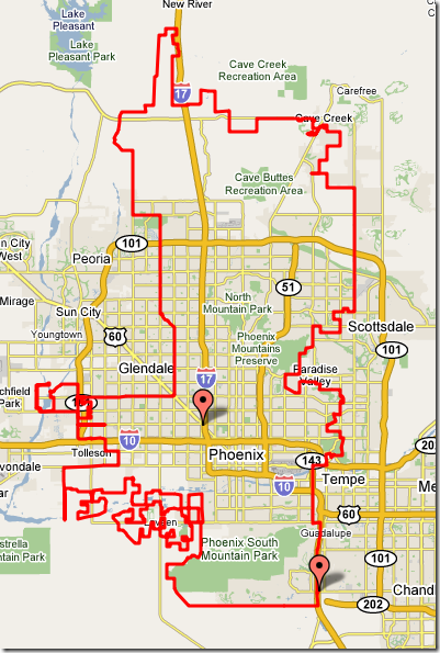
City/town boundaries: Enter a zip code, or click on the map, and get the boundary of the city/town jurisdiction for that area where appropriate:

phoenix

County/FIPSCSA: Enter a zipcode, or click on a spot, and get a map similar to the one above for either a county or a FIPS (Federal Information Processing Standard) Core-Based Statistical Area, with a placemark near the center of the polygon with the relevant information, including code numbers.

There is also a US geocoders (get a latitude/longitude for an address), and a reverse geocoder (enter the lat/long or click on an address, and get back the closest addresses to a point).

The related Maps.Huge.Info site has links to most of the above services, but also a few more as well:

  • US telephone area code maps
  • Plotting zip codes by line boundary instead of overlay map (as at the top)
  • Australian post codes
  • A zip+4-based reverse geocoder

Finally, there’s a page of the free PERL code they use for converting a polygon of points into a Google Maps polygon.

Via GoogleMapsMania.