blankblank blank


Archive for the 'Web apps' Category Page 9 of 10


Geographic Time Animations

While I was writing the previous post on xls2kml, which has the ability to add time data to point placemarks in a Google Earth KML file, I got an email from someone who was looking for ways to create time-animated geographic displays. Digging through my brain and bookmarks, I came up with the following:

– If you have ArcGIS 9.2, there’s a free extension called TimeSlider from Applied Science Associates that lets you animated multiple data series that have associated dates or times. Haven’t tried it myself (I’m still stuck with 8.2).

TimeMap, from the University of Sydney’s Archaeological Computing Laboratory, creates time-based web mapping displays. From the “About” page:

“TimeMap TMJava is a novel mapping applet which generates complete interactive maps with a few simple lines of html. It provides a way of easily enriching web pages with historical or contemporary information that goes far beyond static jpg map images. It’s easy for beginners, yet provides completely customizable power and distributed backend database connectivity for the expert. It’s free for personal use.

TimeMap’s unique time-handling provides an engaging and intuitive method of delivering historical, community, government, research and business information. Combining mapping and the time dimension gives new ways of visualizing urban growth, the spread of empires, heritage sites, environmental change, weather patterns, traffic flow, earthquakes, mobile network faults, and much more ? ranging in time scale from millions of years to seconds.

TimeMap time-filters and animates maps on the fly, connects to datasets anywhere on the web and can search for and load thousands of local maps dynamically as you zoom and pan. TimeMap can filter huge datasets server-side and download only the data needed, or work standalone off a CD. It adapts legends dynamically as scale changes and generates hyperlinks on-the-fly between objects on the map and web pages, and is completely customizable with XML. Yet the applet weighs in at only 350K! ”

The TimeMap website has downloads, documentation, and sample applications. An open source version is on the way. Haven’t tried it this one yet either, but may post on it at greater depth in the future.

– Google Earth, of course, has added time-related coding to KML. But you still can’t add time information to data using the Google Earth application itself. Options for adding time coding are:

  • Add the time data manually to the KML file, as I did in my earlier sea level rise animations; this is currently the only option I know of for animating image overlays, and path/polygon KML files.
  • Use xls2kml to timecode point locations
  • Create a Google KML network link using Google Spreadsheets with timecoding added to point placemarks; Google has a tutorial page describing how to do this.
  • Create a KML network link to an EditGrid spreadsheet; OgleEarth has more info.
  • And I’m working on another way to create animated Google Earth KML files; more on this when it’s ready …

9/25/2007: Added info on EditGrid spreadsheets.


Draw/Label On Google Maps, And Generate GPX/KML/Embeddable Maps

Not as useful as it was before Google Maps MyMaps came along, but quikmaps.com has many of the features that MyMaps does, and a few it doesn’t:

– Draw lines on a map, either with line segments or arbitrary freehand (no polygons, unlike MyMaps)

– Add points to the map using a larger variety of full-color icons than MyMaps

– Add text labels directly to the map (not in MyMaps)

– Embed the map and your content in your website

– Export the map data directly into either KML format or GPX format for downloading into your GPS


Statetris – Tetris With The US States

In Statetris, you rotate and position the state shapes so that they fall into the correct position, a la Tetris. Brings back not-so-fond memories of all the time I used to waste on computer games. Other useless geographic activities include Smoke Signals (animated smoke messages in Google Maps), and Crop Circle (personalized crop circles).

Via BoingBoing.


Advanced Image Mosaicking With Regeemy

If I need to convert a paper map to digital format, and the map is larger than my scanner, I usually scan the map piecewise, and then mosaic the pieces back together into a single image. If I’m lucky, I can get the Photomerge feature of Adobe Photoshop to put all the pieces back together into a single whole, and get good matching at the edges. More often, though, Photomerge can’t get all the pieces to fit together, and I have to match up the sections manually using control points, which is a real pain. But I’ve found a program that automates the process of finding control points and mosaicking map sections, and produces far better results than Photoshop’s Photomerge function. It can also mosaic images shot at different angles and rotations (like satellite/aerial photos) and overlay images to look for temporal changes. If the first image is georegistered, it can automatically georegister the product mosaic image as well.

More after the jump ….

Continue reading ‘Advanced Image Mosaicking With Regeemy’


Exporting KML Data From Google Maps MyMaps To A GPS

AnyGeo and OgleEarth both post today on TakItWithMe, a new free web service that lets you upload Google Maps MyMaps KML data directly from your browser to a GPS unit. It’s limited now to Garmin units, since it relies on the Garmin Communicator plugin. And while the device support page indicates that some serial interface GPS receivers will work, Garmin says that it works best with USB devices, and doesn’t promise good serial support.

For other GPS manufacturers, and for KML files created in Google Earth or by some other means on your local computer, I’ve posted before about a number of free ways to upload KML file data into a GPS unit:

Exporting Data From Google Earth To A GPS Unit
Using GPS Utility To Import/Export GPS Data To/From Google Earth
GPS Trackmaker: A Better Solution For GPS Export/Import With Google Earth

There’s another way for Garmin units, but I’m waiting until it’s out of beta to post on it ….

Addendum: Google Earth Blog points out that TakItWithMe can also convert KML files to GPX format, so that you can upload them to a non-Garmin GPS using any program that accepts GPX, like EasyGPS or GPS Trackmaker.


Documenting A Journey With Maptales

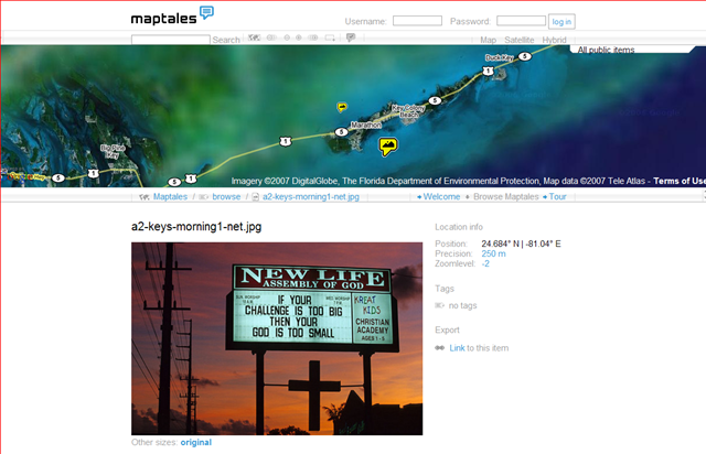
Download Squad posts about Maptales.com, a site that lets you upload geocoded photos with text (from a blog, mobile phone or Flickr) from a journey’s route to tell a story, and plots links to the journey photos in a Google Maps interface. The standard Google Maps navigation has been replaced by icons at the top (to the right of the search box), which take some getting used to. Not a lot of content right now, and you have to apply for an invitation key by email to use the site.

maptales.png


Creating GPS Waypoints Online From The USGS Geographic Names Information System (GNIS)

The USGS GNIS is a gazetteer database of close to two million geographic landmarks in the United States (and, oddly enough, Antarctica as well). Types of landmarks include manmade (airports, hospitals, populated places, etc.) as well as natural (summits, arches, cliffs, etc.). There’s a direct interface to the GNIS at the USGS’s Board Of Geographic Names website that lets you search by feature name and get:

  • Federally recognized feature name,
  • Feature type,
  • Elevation (where available),
  • Estimated 1994 population of incorporated cities and towns,
  • State(s) and county(s) in which the feature is located,
  • Latitude and longitude of the feature location,
  • List of USGS 7.5-minute x 7.5-minute topographic maps on which the feature is shown, and
  • Names other than the federally recognized name by which the feature may be or have been known.
  • Links to sites offering map viewers for graphical display of the feature
  • Link to site offering information about the watershed area in which the feature is located

You can also download tab-delimited text files for individual states, or all states in one large file.

There’s another site with GNIS data, plus some extras. Wayhoo.com lets you search a copy of the GNIS database for US features, but has some additional options as well:

  • Browse for features by county, filtering by feature type
  • Add features to a waypoint list, then export the list directly from the browser to any GPS waypoint format supported by GPSBabel (GPX, EasyGPS, Garmin MapSource, Fugawi, OziExplorer, etc.)
  • Plot the feature’s location in Google Maps, Yahoo Maps, Virtual Earth, Terraserver, and a bunch more
  • Find the National Weather Service 7-day forecast for that location
  • Find the nearest recorded Degree Confluence point
  • Find the nearest geocaches
  • And a bunch more …

And Wayhoo requires no registration; you just need to have cookies enabled on your browser if you want to create a waypoint list.


MapMyRide.com

Lifehacker posts about MapMyRide.com, a new workout-oriented Google Maps site:

  • Display a USGS topo map in addition to the standard Google Maps views
  • Measure distances
  • Import a GPS track
  • Create a route, export it to GPS or Google Earth format, annotate it with markers for parking, bathrooms, etc.
  • Calculate the number of calories you’ll burn
  • Save and track your data (requires registration)

Free, but lots of ads (the price you pay …). Some of the features (e.g. Map Settings, Workout Calculator) don’t seem to work in the Firefox browser, but work in Internet Explorer (Windows).