blankblank blank


Archive for the 'Google Earth' Category Page 18 of 25


Plotting Public Land Survey System Locations In Google Earth

A recent post covered a website with Public Land Survey System (PLSS) shapefiles, and a geocoder that gives the PLSS data for an entered set of coordinates. In the comments, Bill Clark points out his Township And Range website, which links the PLSS data to Google Earth.

You can:

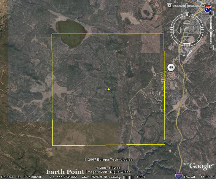
– Enter a State, Principal Meridian, Township and Range, and be flown to that square in Google Earth:

View PLSS Public Land Survey System data in Google Earth

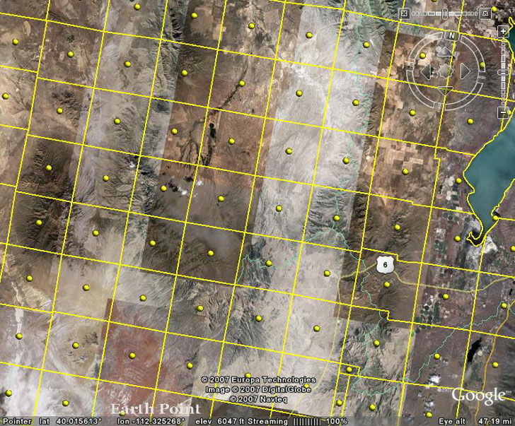
– View National Atlas PLSS data directly on Google Earth (full coverage of the central and western US, but no mile sections, and less accurate than BLM data):

View PLSS Public Land Survey System data in Google Earth

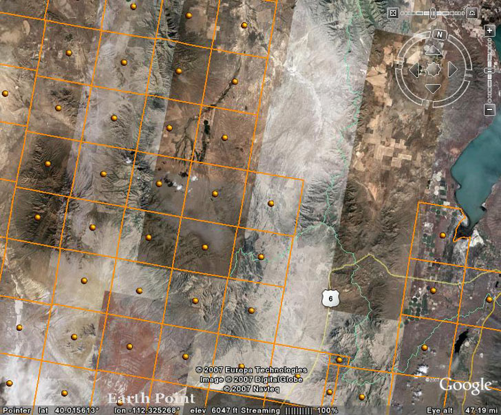
– View BLM PLSS data directly on Google Earth (less coverage than the National Atlas, but more accurate, and shows mile sections):

View PLSS Public Land Survey System data in Google Earth

You have to zoom in to the point that less than 200 townships are visible; the closer you zoom, the smaller the section that become visible. And be patient, it can take several minutes for the data to load in completely. Click on the ball in the center to see the PLSS info for the squares.

Nice job, Bill!


Have You Heard Google Earth Lately?

The BBC reports on a project by Wild Sanctuary to add their extensive collection of natural sounds (3500 hour, and 15 thousand different species) as a layer to Google Earth. They’re “in talks with Google, although no official agreement has yet been made”.

PS Make sure you check out the media player at the bottom of the Wild Sanctuary website for examples of their natural sound resources.


Saving Money By Using Free Geography Tools Instead Of Geographic Data Services

SlashGeo links to a website that, like a number of others, offers services to convert graphic images and vector data into Google Maps, Google Earth, and Virtual Earth formats. There’s certainly a niche for services like this, especially if you don’t have a lot of background in working with geographic data. But if you have even a little bit of that background, you can save a lot of money by doing it yourself.

1. Converting PDF files to Microsoft Virtual Earth format requires first converting them to a graphic format like JPG or TIF, which you can do with for free with PDFCreator. Next you have to georeference them, assigning coordinates to the individual pixels in the image. I’ll be covering a number of free ways to do that in the future, but for now, it’s enough to say that you can georeference and image with the free GIS program MapWindow, or with MicroDEM. Finally, to convert the georeferenced image to Virtual Earth format, you can use Microsoft’s free MapCruncher utility. Saves about $499 versus outsourcing it, at the cost of a just a little time.

2. For plotting vector data like shapefiles on Google Maps, you can use the free utility Google Map Creator. Need to convert AutoCAD files to shapefile format? There’s a free plugin for MapWindow that lets you do that. Saves you $349 over outsourcing it.

3. Finally, for putting GIS Data into Google Earth format, there are a number of free or cheap options that let you do that. And to convert PDF files into a Google Earth format, use the process outlined above to convert a PDF to an image, and then georeference it. If you need to convert the image from UTM or some other coordinate system to Google Earth’s native coordinate system of latitude/longitude, you can use a free utility like GDALWarp (also to be covered in the future on this blog). You can then use a cheap ($20) utility like Valery Hronusov’s SuperOverlay to convert that image, or any georeferenced image, to a tiled Google Earth format. $20-50 in software costs, at most, versus an outsourced cost of $199-499.

BTW, if you have the need for any of these services, and don’t feel comfortable doing them yourself, email me with your requirements, and I’ll quote you a price that’ll be far less than those listed above ;-).


Yahoo Pipes Adds Google Earth Support

Yahoo “Pipes is a free online service that lets you remix popular feed types and create data mashups using a visual editor” (from the Pipes website). They’ve now added support for Google Earth, where they geocode address or location results from a Pipe, and convert them into KML format automatically. See the post on Google Earth Blog for more info.


New Version Of Globe Glider

This is too cool for me to even try to do it justice; go visit Google Earth Blog for the full details.


A Few More Free Toolsets For ArcGIS

Another in a series of posts on free toolsets for ESRI products. Today’s sets comes from Valery Hronusov, author of such useful paid tools as SuperOverlay (a stand-alone program for creating tiled raster image datasets for Google Earth), and KMLer (an extension for ArcGIS that exports data in KML format). The free tools are only for ArcGIS, versions 9 and higher.

Continue reading ‘A Few More Free Toolsets For ArcGIS’


Calculating And Mapping Climatic Change With EdGCM

Modeling and calculating earth’s climate, with the many parameters involved (sun, atmosphere, land, water, snow/ice, etc.), used to be the exclusive domain of supercomputers, and still is for the most complicated models. But there’s a simplified computer climate model available for free for both Windows and Macintosh that lets you run climate models on a desktop PC, and allows you to investigate both past and future climatic scenarios.

Continue reading ‘Calculating And Mapping Climatic Change With EdGCM’


Online Google Earth Utilities For Buffering And Area Calculations

I’ve been meaning to post about this site for a while, and it’s natural to do so after posting about GE-Path. The Geo Utilities website offers online tools that let you simplify KML files by reducing the number of points, create buffers (areas around a point, line or area of a specific size), calculate polygon areas, and determine the intersection location of two different layers.

Continue reading ‘Online Google Earth Utilities For Buffering And Area Calculations’