I suspect this isn’t new to most ESRI users out there, but the ESRI Developer Network hosts a large number of free, useful, downloadable utilities for most of ESRI’s current and former products at the Code Exchange (click on “Search ArcScripts” and select your desired product for the useful stuff). For example, here’s a direct link to a listing of 1130 utility scripts for ArcGIS Desktop.
Thanks to Valery Hronusov for the tip.
Yesterday’s post dealt with Trimble’s Planning Software, which lets you calculate a GPS-satellite-geometry-dependent error parameter called “Dilution Of Precision”, DOP for short. The calculated DOP can tell you when the GPS satellite geometry is favorable (or unfavorable) for reducing errors due to GPS satellite geometry. But those calculations assumed that you had an unobstructed view of the entire sky, and had line-of-sight to every GPS satellite above the horizon. In many cases, though, your view of GPS satellites is likely to be obscured, either by local obstacles like buildings and vegetation or more distant ones like topography. There’s not much you can do about taking the former into account, but there is a way to deal with the latter to some degree.
Continue reading ‘Determining Terrain Effects On GPS Accuracy’
Tomorrow (5/9), HP Labs is expected to officially announce the free beta release of Mscape, software for GPS-enabled portable devices running Windows Mobile, to create “Mediascapes”. From the website:
“Mediascapes are mobile, location–based experiences that incorporate digital media with the sights, sounds, and textures of the world around you. A mediascape blends digital images, video, audio and interactions with the physical landscape. Games, guided walks and tours, and destinations are among the mediascapes created to date. Download a mediascape onto a portable device, and see how your landscape comes alive as you move through the environment.”
Although the official announcement will be tomorrow, the Mscape website is already “live”. There you can download the free client software for your Windows Mobile device, free sample Mediascapes, and a free toolkit (Windows XP only) that lets you create and preview your own Mediascapes on your PC.
Via Webware.
Following up on the previous post, an email pointed me towards Map Of The World – Shaded Relief, another Google Maps terrain-shaded relief site. It has some pros and cons compared to the GeoLabels website, but the two are a good complement to each other.
Pros:
- Larger Google Map size
- Ability to turn off man-made features (Relief vs. Relief+)
- VE button that overlays Virtual Earth maps (road map only
- “Search for place or feature” returns all features containing the search term, not just man-made, and plots them as markers on the map
- Far superior bathymetric (underwater) shading
Cons:
- Terrain shading not as colorful or visually appealing as GeoLabels website
- Maximum zoom level lower
The Geolabels website offers another image option button for Google Maps, along with the standard Map, Satellite, and Hybrid buttons: Relief. This button gives you views of the terrain in an area, shaded by light at an angle and color.
Go to the website, and either zoom in on an area of interest, or enter the name of a populated place in the box at the upper left and click “Go” (if you hit “Enter” after typing in the name, you’re likely to get an error screen). At left, you will get a list of world localities in the database that match that name; click on one, and the map will zoom in on that location:
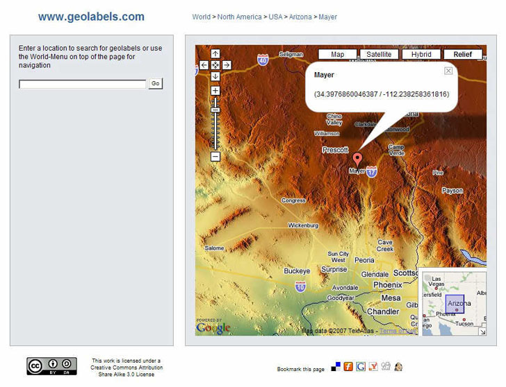
You will also get a marker at the location of the name you entered, along with a message box showing latitude and longitude to way too many decimal places. You can zoom in for a closer view:
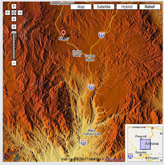
Or zoom out:
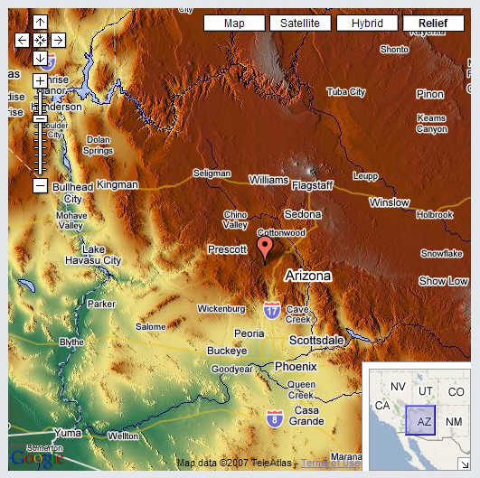
Major rivers and bodies of water, major highways, and populated places are also shown on the map. Keep in mind, though, that the color shading represents altitude, not vegetation, e.g. in the image above, all that green around Phoenix definitely doesn’t represent lush vegetation. Other sites offer contours or topo maps in the Google Maps interface, but the Geolabels website is a nice complement to them.
Modified 8/26/07 to update URL.
Broadly speaking, errors in the position a GPS receiver gives you are due to two factors: the precision with which the distance to each GPS satellite is known, and the geometry of the satellites, i.e. how closely or far apart they’re spaced across the sky. Distance errors can be compensated for by using WAAS, post-processing, averaging, and other techniques, but satellite geometry is a fundamental limiting factor. The maximum position accuracy you can achieve is limited by GPS satellite geometry.
Continue reading ‘Determining Local GPS Satellite Geometry Effects On Position Accuracy’
Previous posts have shown how to display parameters such as elevation, slope, and aspect in MicroDEM on a “global basis”, plotting these parameters individually across an entire DEM. But it’s also be useful to show which areas on a DEM fit within a specific range of values for these parameters, e.g. what areas have a slope greater than 50% but less than 100%. MicroDEM can do this kind of terrain categorization.
Continue reading ‘Selecting Areas Based On Terrain Categories And Values: Slope, Elevation, Aspect And Relief’
An earlier post covered a Google-Maps-based reverse geocoder, where you could click on the Google Map interface, and get a list of addresses close to that point. Reverse Geocoder for the United States is another Google-Maps-based application in the same vein. While it doesn’t have as many features as the Geonames reverse address geocoding site, it uses the Google Maps interface better, with a larger map display (one of the largest I’ve seen online) and the sliding zoom control (missing from the former site).
It’s easy to use: click on a point on the map, and you’ll get a marker placed there, and the latitude/longitude displayed in a box at the upper right. Click on “Submit point”, and the closest addresses to the selected point will be displayed as markers on Google Maps, and in a list on the right. Click on an address on the right, and a marker balloon will pop up on the map at the corresponding address. It also gives you the Zip+4 postal zip code for the address, which the Geonames site doesn’t. You can also enter a latitude and longitude in the upper right separated by commas, submit the point, and get similar results. A companion site does geocoding – submit an address, get back the latitude/longitude, and the address plotted in Google Maps (make sure you include either the city/state or zip code in the entered address).
Coverage is limited to the lower 48 US states and Alaska. Geocoding seems to use the Tiger database, whose accuracy varies depending on location.

