blankblank blank


Author Archive for Leszek Pawlowicz Page 43 of 79


Sources For Free Garmin .img GPS Map Files

As mentioned in the previous post, you can use MapSet Toolkit to add any .img Garmin map file to MapSource. If you want to try out the process on some free .img files, here are some sources for .img files, as well as some data in executable files that install it automatically in MapSource without the need for MapSet Toolkit:

  • Mkgmap wiki: .img files for the UK, South Africa, and Africa
  • OpenStreetMap wiki: Files for Germany/Netherlands and the entire world (read the caution for the latter, though; it might crash MapSource if you install it there)
  • GPS Vector Map Morocco has Garmin maps for Morocco and Western Sahara.
  • Yunnan Explorer has some topographic maps for areas of Yunnan Province in China.
  • cgpsMapper MapCenter (and MapCenter2): Maps from around the world, browsable by country and type. Coverage is hit-and-miss, but for some countries it’s very good. For example, the New Zealand Open GPS Project is creating road maps for the entire country as a complete set with an installer that puts them automatically into MapSource.
  • Tracks4Australia has installable map tiles for all of Australia.
  • The GPS Maps site has downloadable maps for Garmin mapping GPS units. Levels of detail included are mixed, but the maps can include topographic contours, land details, and road maps in various levels of detail (either VMAP0 or VMAP1). Areas covered:
    • The Caribbean (including Cuba and parts of South Florida, Central and South America)
    • Bermuda
    • Japan
    • Antarctica
  • Greece GPS Maps has … maps of Greece.
  • And one of these days, I’ll get around to posting on some of the free options for creating your own .img files …


Adding Garmin .img Map Files To MapSource

8/29/09: Some have reported issues with the latest versions of both cgpsmapper (0098c) and MapSet Toolkit (1.62). If you have a problem with these, try using older versions of both programs, available at this link. Also, if you have problems with installing a mapset, try right-clicking on the program and choosing “Run As Administrator”; Windows crappy security system sometimes blocks programs from modifying the Windows registry, which MapSet Toolkit needs to do to install a mapset.

In the last post, OpenStreetMap data was converted to a Garmin .img map file, which can be directly uploaded to a Garmin GPS unit using SendMap or MapUpload software. But it’s more convenient to use the MapSource software that comes with most Garmin GPS units to do this, since you can preview the map data in that program, and create/upload multiple maps and mapsets easily. The best program I’ve found to do this is MapSet Toolkit; you’ll also need the map compiling program cgpsmapper, free for creating basic maps for personal use.

Using the process in the previous post, I downloaded some street data for London, and converted it to a Garmin .img file. I then used the following steps to add the .img file to MapSource:

1. Created a subdirectory in my C:\Garmin directory called “London”, and copied my “63240001.img” file there. Note: MapSet Toolkit will only recognize .img files with a numerical filename. If you rename the file with a non-numerical name, it won’t show up.

2. In Mapset Toolkit, chose that file with “Select IMG files”.

3. Highlighted that file, and “Add”ed it to the selected IMG files. You can add multiple .img files as part of a single set of files.

4.Chose the same directory that contained the .img file as the “Mapset directory” to be used

5. Assigned a name to the mapset, “London”

6. Chose a 4-digit “Product Code” number (“8765” in this example); the only limitation is that it not conflict with any other product codes (which are displayed in the “Uninstall Mapset” box at the right).

7. You can enter copyright info if appropriate, but it’s not required here

8. At lower left, chose the directory where cgpsmapper.exe is located (usually the C:\Program Files\cGPSmapper directory), and selected the cgpsmapper.exe file

9. The “Convert (Product>Families)” section was left blank; more information about Family ID and TYP files is available in the cgpsmapper manual.

10. Checked the box marked “Install in MapSource”. Checking “Blank overview maps” will eliminate the map preview in MapSource. I’ve found that for some mapsets, leaving this box unchecked will result in a crash of cgpsmapper, and a failure of the installation; in that case, check the box and try again.

11. Clicked “Start”, and shortly thereafter got a message box saying “Convert termined” (sic).

12. In the “Uninstall Mapset” section, there’s now a new listing for the added map.

The program screen after all these operations looks like this:
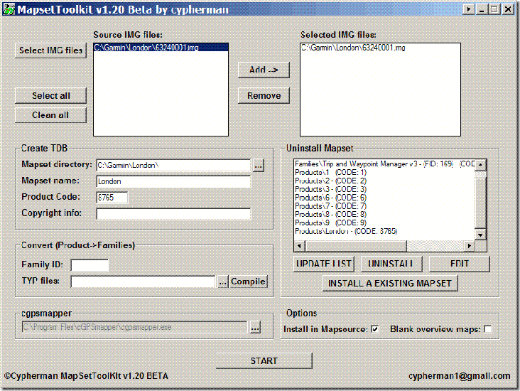
Mapset Toolkit

If I now open Mapsource, the dropdown at the upper left has a selection for “London”; selecting it brings up the OpenStreetMap data:
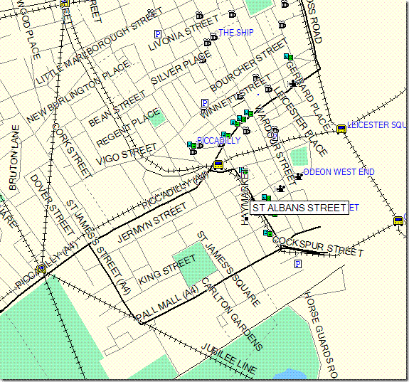
Londonmap

I can now select this dataset along with any others I might want, and upload it to my Garmin.

You can also use the “Uninstall Mapset” section to remove mapsets from MapSource as well. Occasionally, installing a mapset will cause problems with MapSource starting up; usually, uninstalling the mapset with MapSet Toolkit will fix that problem. You may have to run the program in “Administrator” mode to get this to work (see the comments below).

There’s more complete documentation available in PDF format at the MapSet Toolkit website. And a more complete, technical tutorial on doing this is available at the GPSFileDepot.

Addendum: There are two other programs floating around that can also add .img files to MapSource. M3 is available at MalsingMaps.com, where you can also find free Garmin maps for Borneo, Malaysia and Singapore; free registration required. However, I’ve found that if you install a MapSet using M3, other mapsets installed by either MapSet Toolkit or with the Garmin installer can disappear off of the dropdown menu (they come back after you uninstall the offending mapset). GPS Map Manager is better than M3, but MapSet Toolkit has a better interface and more capabilities.



Interactive US Census Data Viewing In Google Earth With The GE-Census Explorer

Another slick brand-new tool from Zonums Software, the GE-Census Explorer lets you interactively display, plot and analyze US Census data in Google Earth.

The initial interface is deceptively simple:

GE-Census-Explorer

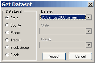
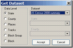
Folder icon at left: “Get Dataset”. Lets you select the geographic extent of the dataset you want to look at:

Get DataSet

Continue reading ‘Interactive US Census Data Viewing In Google Earth With The GE-Census Explorer’


Converting OpenStreetMap Data Into GPX Or Garmin .img Format

The OpenStreetMap project is “a free editable map of the whole world”, created by users with GPS data or by tracing over Yahoo Maps images (allowed by Yahoo) or public domain Landsat data. Data is viewable by anyone; registration assigns you a username and password that lets you contribute your own data to the project, using a multi-platform map editor like JOSM or Meerkartor. JOSM also lets you save downloaded data from OpenStreetMap, and this data can be converted to the .img format used by Garmin mapping GPS units, or converted to a GPX file for general import into GPS units.

The current OSM data in Garmin .img format is available for the UK, South Africa, and Africa at the Mkgmap wiki site, and for Germany/Netherlands and the entire world at this site. But if you want the most recent data, data subsets for different areas, or don’t want the entire dataset for the world, you can download data for a specific area from OpenStreetMap and convert it yourself to a Garmin .img file. Data coverage is still spotty, so you should check the OpenStreetMap site to see whether the area you’re interested in has data. If yes:

1. Click the “Download some data from the OSM server” link in JOSM, and specify the latitude/longitude bounds of the area you’re interested in (no more than 0.25 degrees square) (note: you’ll need to have entered your OSM username and password in the preferences section).

2. Save the downloaded data as an *.osm file if you want to convert it to Garmin format, else save it as a GPX file.

3. Use the command line Java program Mkgmap to convert the *.osm file to a Garmin img map file (always the same output filename, “63240001.img”, but you can rename it to a different 8-digit number after creation) . If your osm file is called test.osm and is in the same directory as mkgmap.jar, the command syntax is “java -jar mkgmap.jar test.osm”. Enter the appropriate data path if it’s located in a different directory, but the 63240001.img file will always be created in the directory where mkgmap.jar is located. If you’d prefer a GUI, I’ve created a simple one for Windows that you can download here; unzip it to the same directory as mkgmap.jar and run it. The *.osm file will have to be in the same directory as mkgmap.jar for this GUI to work; sorry about that.

4. Upload the .img file to your Garmin GPS using a program like sendMap, or MapUpload if you have a compatible Garmin unit. For GPX files, use the upload program of your choice (e.g. GPS TrackMaker or EasyGPS).

Thanks to David from the UK for the tip.


High-Resolution Aerial Photography And DEM Data For Utah

The state of Utah’s Automated Geographic Reference Center (AGRC) has spectacular high-resolution color aerial photography and digital elevation model (DEM) data available for the entire state, with limited areas having even higher spatial resolution.

  • 5-meter DEM data derived from aerial orthophotos is available for the entire state in ASCII ArcGrid (*.asc) format. You can use the FTP site along with statewide index shapefile to determine which files to download, or use the Interactive Map site. You may have to right-click on the file and choose “Save Link (Target) As”, otherwise the ASCII Grid files may open up as text in your browser. MicroDEM can open ASCII ArcGrid files directly (if you get an error message, zip the DEM file, then open the zipped file). Here’s a reflectance image of a 5-meter DEM of the Zion National Park area:

Continue reading ‘High-Resolution Aerial Photography And DEM Data For Utah’


Handling TIFF WorldFiles With GeoTiffExaminer

The TatukGIS Viewer and MicroDEM are handy all-purpose utilities to use for embedding and extracting worldfile data from a variety of image formats. But if you’re only working with TIFF image files and their worldfiles (*.tfw, *.tifw), GeoTiffExaminer may be a better choice:

– Small program (less than 500K installed)

– Modifies only the header, and doesn’t touch the image data. Both TatukGIS Viewer and MicroDEM rewrite the images when they save them, and sometimes you can get minor shifts in the color palettes that way

– Supports indexed color (the standard format for USGS DRG topo maps); MicroDEM doesn’t, and TatukGIS Viewer doesn’t always save the color palette on indexed colors correctly.

– Simple interface

There are two modes of operation: opening a GeoTiff, extracting the geodata and using it to create a worldfile; and opening a plain TIF file with a worldfile, and embedding the geodata from the worldfile in the TIF to create a GeoTiff.

Continue reading ‘Handling TIFF WorldFiles With GeoTiffExaminer’


Goofing Around With Pan-sharpening

Orbiting satellites often have two types of digital imaging sensors:

– Multispectral, i.e. different sensors for different colors (including IR), or different filters in front of the same sensor. Each individual band can be shown as a black-and-white image; multiple bands can each be assigned a color, and combined to form an RGB color image.

– Panchromatic, “meaning all the colors”, a single broad-spectrum sensor. This are usually displayed as a monochromatic image (i.e. black-and-white).

The panchromatic sensors usually have a higher spatial resolution than the multispectral. For example, on the Landsat 7 spacecraft, the 6 multispectral bands have a spatial resolution of roughly 30 meters (a seventh has 60 meters), while the panchromatic sensor has a resolution of about 15 meters. Here’s an example of an image created from three of the Landsat multispectral bands (data from the Global Land Cover Facility):

Continue reading ‘Goofing Around With Pan-sharpening’


Google Earth Index For US Army Map Service Topographic And City Maps

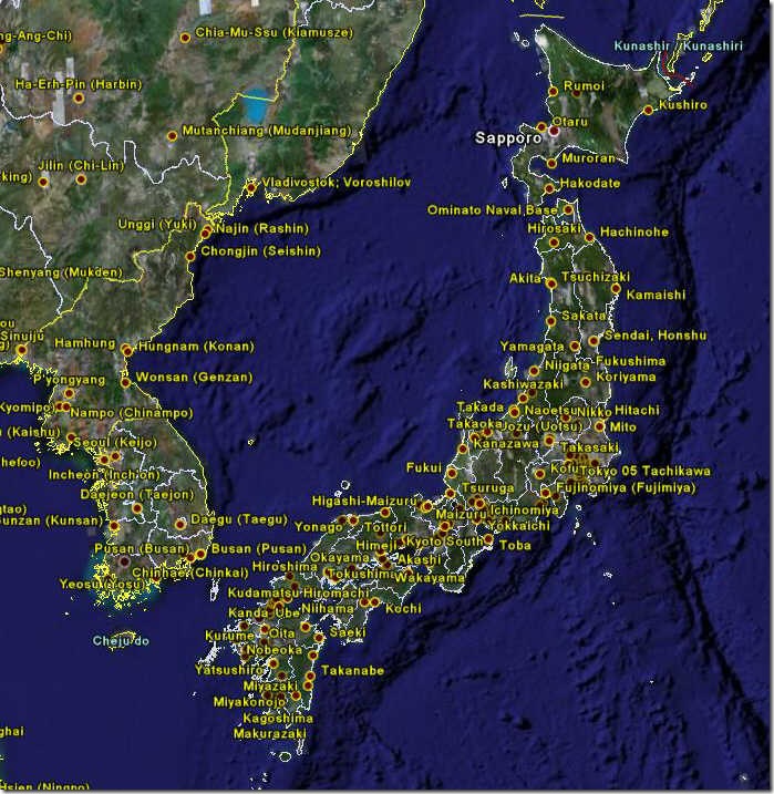
In a previous post on large-format downloadable historical maps, I noted that the Perry-Castaneda Map Library has an interesting digital collection of Army Map Service topographic maps dating from the 1940s and 1950s, covering large areas of Asia and Africa, along with city maps for Japan, China, Korea and Taiwan (Formosa). Over on the Google Earth Community, “PriceCollins” has been creating a KMZ index file for these maps. So far, he has indexed all 435 city maps:

asiacity

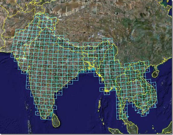
And 413 1:250K maps covering most of India, Pakistan and Southeast Asia:

seasiamaps

Each city and rectangle placemark contains a direct download link to the map image at the Perry-Castaneda Library. From the post, it sounds like eventually all the maps will be indexed in this fashion, so it’s worth bookmarking the site and checking it regularly for updates.