Cartisan Maps site is now dead (domain name grabbed by someone else); however, I have uploaded the two files to MediaFire, and updated the links to the spreadsheets to point to these files. There also may be problems running this in Excel, as it seems to want a password for some functions; however, it runs fine on the free Office clone LibreOffice..
Cartisan Maps has several free spreadsheet tools for basic coordinate conversions; each one can handle up to 5000 sets of coordinates. Files are in Microsoft Excel format, but seem to work fine in OpenOffice 2.4.
Cartisan Map Coordinate Converter: Enter latitude and longitude in separate columns for degrees, minutes and seconds, and have them converted to a DD MM SS string, DD MM.d string, or numeric decimal degrees. The first column, labeled Hemisphere, is multiplied times the longitude, and if you leave it blank, the calculated degree value for longitude will always be zero. Enter “1” for East longitudes, “-1” for West longitudes, and make sure your longitude degree value is always positive; or, enter a “1”, and then enter positive and negative values for the longitude degree value.
Cartisan Total Map Coordinate Converter: Converts from decimal and DDMMSS latitude/longitude to UTM and MGRS, and back again; includes support for 14 datums, including NAD27 and WGS84. Also has another version of a converter from degrees/minutes/seconds to decimal degrees and back, similar in output to the one above.Requires that you have macros enabled in your spreadsheet program. Notes: 1. File is in the .RAR compression format; if your unzipping program can’t handle that, try 7-Zip. 2. Enter your coordinate data in the areas highlighted in green in the spreadsheet.
While labeling items in Google Earth, you’re able to modify the font color, size and opacity. But one curious omission is the inability to change the font; you’re stuck with the Google Earth standard:
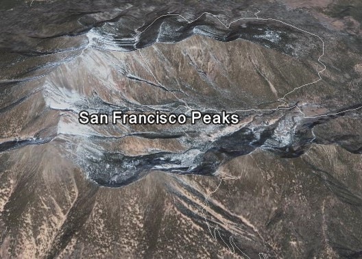
The font also stays the same size regardless of how far away you are from the labeled area, which can be useful sometimes. But if you have a lot of labels, this can result in lots of labels overlapping, and cluttering up the image. Label text is also all on one line, which can lead to long labels if you want to include lots of text.
Continue reading ‘KML Text Labels For Google Earth’
If you don’t have a large-format, or even medium-format, printer, you can still print full-size maps by chopping (tiling) the image into smaller subsections, and then taping all those subsections together to re-create the original map in large format. I’ve posted before about several ways to do that generically, and another option that lets you tile georeferenced images to a specified scale. For generic tiling, there’s another option: PosteRazor. Multiplatform (Windows/Mac/Linux), open source, runs by itself (no installation required). A simple 5-step wizard walks you through the process:
- Select the image
- Specify the paper size, orientation and margins
- Choose the amount and orientation of the overlap, the areas that are redundant on the printed sheets to compensate for cutting/taping errors
- Select the number of pages to print the image on, with a live preview of the print layou
- Save the tiled images as a multi-page PDF document for printing (it’s very fast at this last step)
Doesn’t have all the bells and whistles of some of the other options, but for a simple tiling operation, PosteRazor is fast and easy.
A previous post linked to a video on how to add in-line KML validation to the Java-based text editor jEdit. There’s now another KML validation option for those who use their own editor to create KML files. Galdos Systems has created a free online KML validator; just submit a link to an online KML or KMZ file or upload the file from your computer (note: for online files, upper/lowercase matters!). You’ll get back a report page with:
- The number of errors found, recommendations and suggestions
- The specific errors found, referenced by line number in the original file
- A listing of the original KML/KMZ file with line numbers, so you can cross-reference the error specified with the line number
An error doesn’t necessarily mean a fatal error; my test file had three errors, mainly related to spec changes in KML, but works fine in Google Earth. Still, even with a working file, it’s useful to see where it doesn’t conform to specs, and for a non-working file it can help you track down the error.
Via the Google Earth Blog.
I’ve posted previously about Moagu, my utility that converts raster map imagery into raster-format maps for some Garmin GPS units. Moagu creates a true bitmap image for Garmin units, with advantages (accurate map and photo reproduction) and disadvantages (slow display times). An alternative approach is to convert a raster image into many small vector polygons, then code those vector polygons as a Garmin-format map. While this approach can speed up display time dramatically, it can also be harder to get good results. There’s a commercial software package called Mapwel that can do this, but I’ve recently been made aware of a freeware program called BMap2MP that also converts raster images into vector polygons, and creates map code for those polygons in the .mp Polish map format. This code can then be compiled into Garmin .img map files using the free or paid versions of cgpsmapper. I’ve spend some time playing with this program, and comparing its results with comparable maps from Moagu.
Continue reading ‘Converting Raster Maps To Garmin Vector Format With BMap2MP’
I did a series of posts a while back on creating custom waypoint icons for compatible Garmin GPS units. If you don’t have the time or patience to make them yourself, there are several free sets of custom waypoint icons available online:
- Western Maps LLC has a set of icons (original size is 16×16 pixels; the magenta color is transparent on the GPS display):
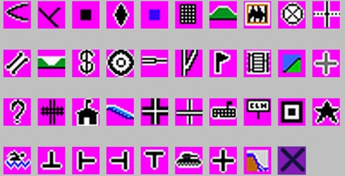


See my original series for info on how to upload these to your Garmin GPS, and use them in the MapSource program.
PhotoKML is a small (<300K download) Java application (PC and Mac) that takes a folder full of geotagged photos, and creates a KML file with points linked to moderate-sized thumbnails of those photos. Interface is simple; select a folder containing georeferenced photos, and a folder where you want to save the KMZ file:
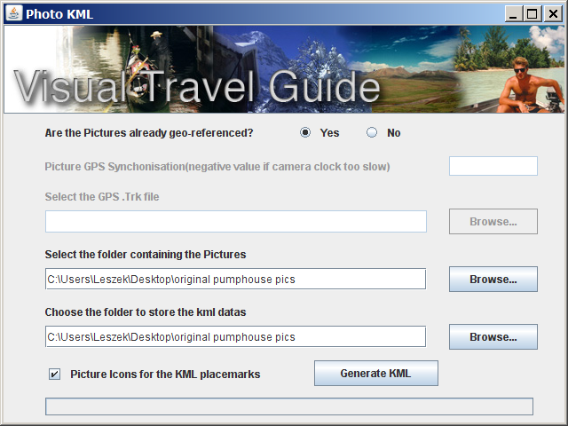
Make sure the “Yes” button is selected at the top. While the program says it’s able to georeference photos using a GPS file, the only format it accepts is the “.trk” format. If you have your track in a more standard format like GPX, good luck finding a program that can convert it to the “trk” format (I couldn’t even get GPSBabel to work). If you want the point icons in Google Earth to be mini-versions of the pictures instead of pushpins, check the box at the bottom.
Click “Generate KML”, and you’ll have your KMZ file in a few seconds; you’ll have to open it manually in Google Earth:
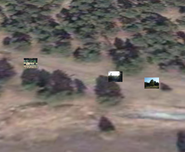
Nothing fancy, but PhotoKML does the job quickly and easily.
The Map overlays for Google Earth site (link fixed – sorry about that) lets you select a source of imagery (Google, Yahoo, Ask.com, Windows Live, OpenStreetMap), and create a KML file that overlays that imagery onto the terrain in Google Earth, with definable transparency. Note: leave the lat/long offset values at 0; these values let you offset the imagery to correct for minor errors in position, not set the initial view position. You can also download a KML file with links to all the imagery, and select the source by checking the appropriate box in the Google Earth pane. Here’s Google Maps’ terrain view in Google Earth:
Continue reading ‘Overlay Google Maps, Windows Live, Yahoo, Ask.com and OpenStreetMap Imagery In Google Earth’

