Two of the factors in determining the accuracy of your GPS positions measurement are how many GPS satellites are visible from your location, and how evenly distributed over the sky they are. Generally, the more satellites that are visible, and the more evenly they’re distributed, the more accurate your position. This is expressed numerically by a parameter called the Dilution Of Precision, DOP for short; the smaller the DOP, the more accurate your GPS position is likely to be.
A few consumer-grade GPS receivers will show you the current DOP; more advanced commercial models can show you a predicted plot of DOP over the course of the day, useful in figuring out the best time to get an accurate position measurement. I’ve posted previously about the free Trimble Planning software, Windows-only software that can generate plots showing the change in DOP over the course of a day. For non-Windows people, there’s now a limited online tool from Ashtech (formerly Magellan Pro) called Web Mission Planning that can provide you with some of that information.
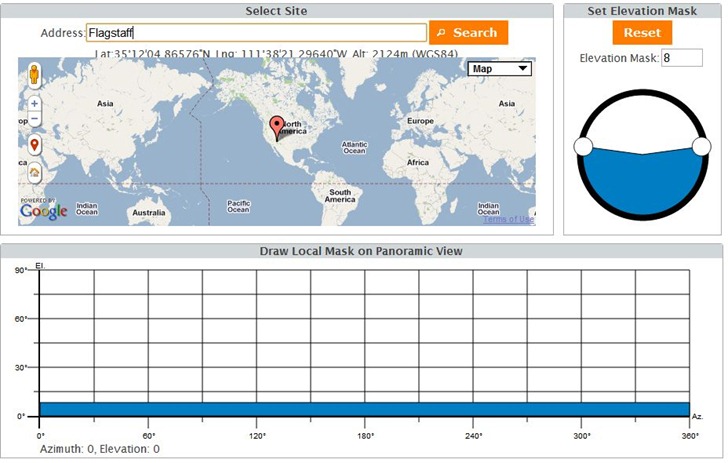
Select your desired location from the first screen – it defaults to your current IP address’s location. Elevation Mask sets the minimum altitude that a GPS satellite needs to have to be considered in the calculations, a simple way to account for sky blockage by objects like trees and buildings. There’s also a “Local Mask” tool at the bottom that lets you fine-tune that blockage to account for individual objects:
You then select a single date, a start and stop time during that date, and which satellites you want to use for the calculation: GPS (the US system), GLONASS (the Russian system, not used by most GPS units), and SBAS (the WAAS/EGNOS real-time correction system). You’ll then get your choice of four plots, some with interactive components.
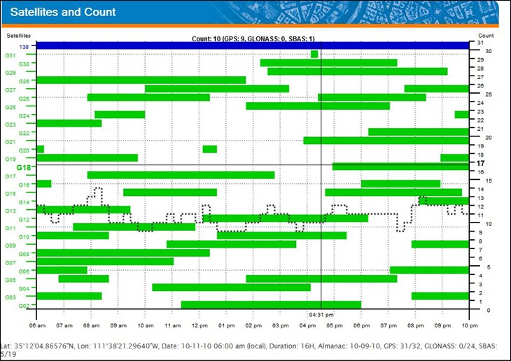
1. The total number, and ID numbers, of satellites visible at any time (interactive; move the cursor over the plot to get more info):
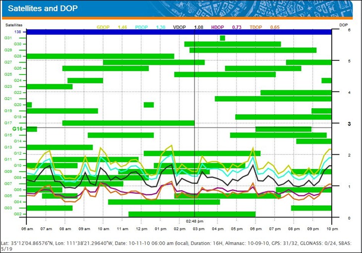
2. A similar plot, but with DOP plotted in colored lines:
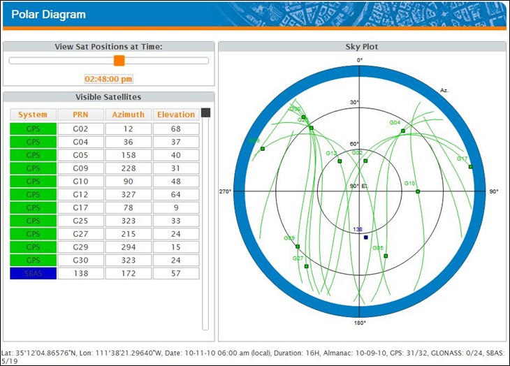
3. A polar diagram that shows the satellite positions in the sky; change the time interactively by moving the slider at upper-left:
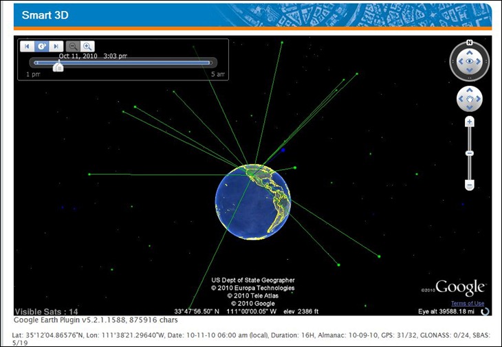
4. A Google Earth plugin view that shows the satellites and the line of sight to your location; a time animation control runs through the entire specified time duration. Fun to watch, but not terribly useful:
Biggest problems with the site are the cluttered diagrams, and the inability to print or output the data into a more convenient format for use in the field; the only option for the latter is to do a screen capture. So if you already have a copy of Trimble Planning software, you can probably skip this site; that program has better controls, and more output options. But if you’re not running Windows, or don’t have access to Trimble Planning, the Web Mission Planning site might be a useful alternative.
Impressive site, thank you.
i am hope that this program help me