I first posted about HeyWhatsThat 2+ years ago; its initial functions included:
A panorama of what’s visible from that location, marking the position of peak geographic landmarks
A list of the peaks, and the ability to show their position relative to your location on Google Maps
Terrain profiles (elevation versus distance from the location to any point on the map).
A plot all the areas visible from that location in red on Google Maps (aka the “viewshed” or “weapons fan”).
Contour lines.
Google Earth export of position, viewshed, horizon line and horizon extent.
Mike Kosowsky has been adding functions to HeyWhatsThat since then, and writes to announce two more:
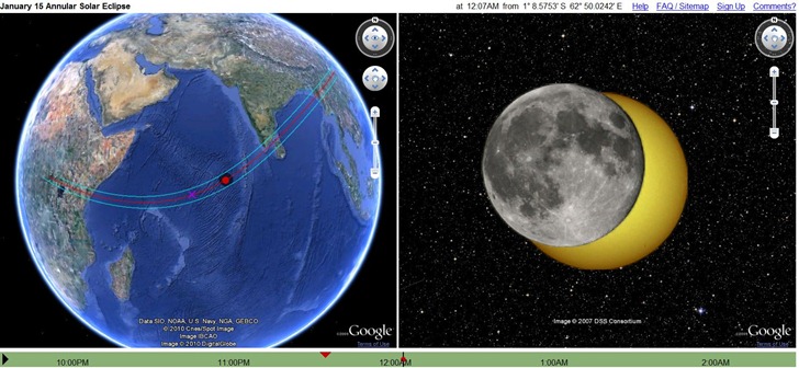
1. A simulator of Friday’s annular solar eclipse:

2. A web app to let you find out what you’re looking at using your iPhone or Android; point your phone’s browser to m.heywt.com.
