FalconView is the Windows mapping part of the Air Force’s Portable Flight Planning Software (PFPS), under development by Georgia Tech since 1994; see this link for an interesting history of the politics of software development in the military. This mapping part, stripped of all mission planning components, has recently been OK’ed by the Air Force for release by as Open Source software. The program has an strong list of features, including:
- Support for many raster/vector map formats
- GeoTIFF
- TIROS TopoBath
- Digital Terrain Elevation Data (DTED) / LIDAR
- Vector Product Format (VPF)
- CADRG
- MrSID
- GeoPDF
- WMS
- ArcMap .mxd (requires that ArcGIS be installed)
- Shapefiles
- KML/KMZ (including network links)
- Moving map supported if you have a connected GPS
- Generate and overlay contour lines from elevation data
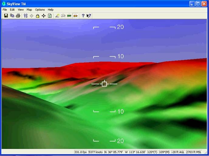
- Skyview mode lets you fly through terrain with overlays by keyboard/joystick control

But this open source version is labeled as alpha software, and it definitely is:
- It wouldn’t install successfully on two separate Vista systems, claiming problems with MapServer initialization; was finally able to get it installed on a Windows XP system
- It’s a huge download (about 500 MB), partially because it also contains critical supporting applications like DotNetFX and Windows SQL Server that must be installed in order to run the program
- Some operations can run slowly on older systems
- Occasional crashes on my system
A bigger problem is that it’s a complicated program with lots of features and a non-intuitive interface. Documentation is currently limited to the help file, which is clearly intended for someone who’s already familiar with the program; no manuals or other documentation is currently available. I struggled for several hours trying to figure out the simplest task possible, add a raster image to the map and view it, before finally giving up. I may not be the sharpest tool in the shed, but I’m not the dullest, either.
FalconView also installs GeoRect, a program to georectify imagery and export it in GeoTiff format. I had hopes that this could be used to convert GeoPDF files into GeoTiff format, since it does open GeoPDF files. But I was defeated on this score as well; while the help file is substantially more helpful than that for FalconView, I was unsuccessful even following their step-by-step instructions. And it appeared as though it would only convert a beta USGS quad in GeoPDF format to a GeoTiff far smaller than would be necessary for full resolution.
I welcome comments from anyone who’s used this program before, and can offer pointers, and I’ll keep an eye on it for the future. But until there’s substantially better documentation available, I’m not going to spend a lot of time struggling my way through this software.
HT to Thomas Larsen.
You are correct that initial learning of how to use FalconView is dificult. I was
convinced it was defective the first week I tried to use it in Iraq. I eventually learned
how to use it and found it very useful to build route maps, and converting images of maps into useful data, .gif, .jpg, bmp. The best learning tool might be a video clip of the screen of several activities, at least to get you started.
I was looking today if there was a newer version than the one I have. I didn’t know a
non-govermental version was released. where can I get a copy to tinker with??
The FalconView I have works best with WinXP, Microsoft was once
again so kind as to remove parts of their OS that we simply don’t need anymore, that is
why FalconView cannot view some files(a SQL issue)in Vista. Microsoft’s response was: have
the program rewritten.
There’s a link to the open source home page at the start of the post. If you know of any publicly available videos or documentation for the program, that would be great.
Thanks for checking out FalconView. We’ve had some new releases since you tried the alpha, so you may want to see the latest beta. (Some of the install and stability issues are fixed up now and some new features have been migrated from the government version.)
It can indeed be tricky to add map data because FalconView is designed to use a database of base maps that display as appropriate based on the scale you are currently viewing. Once the base maps are added to the database, they remain static unless you edit the map database with the map data manager. In that sense, FalconView isn’t quite like other viewers in that lots of maps can be in the database at one time. It can make it a bit tricky to change that database, though. There is a quick start guide on the FalconView web site that helps you to add map data for use by FalconView and there are a few forum topics about specific map types.
(Another thing that makes adding some map data tricky is that FalconView was designed to use mostly specific DoD products that are sometimes in a very particular format when they arrive on CD. I’d like to see a FalconView map data manager that deals with format variations better.)
Thanks again for checking it out. There are now some user forums on the FalconView web site, and Georgia Tech is pretty good about responding to questions there.