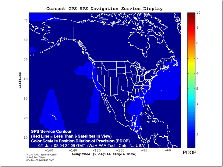
Not too long ago, I posted about a site that offers maps of GPS Dilution of Precision (DOP) for the US and the world for the next three days. The FAA’s WAAS test team has a website that offers both similar and complementary data. In addition to having maximum DOP maps for the current day, similar to the other site, it has real-time maps of the current DOP across the US:
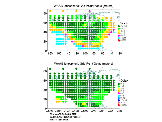
The actual delay in GPS signal due to ionospheric conditions:
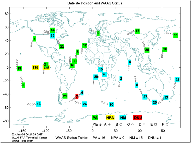
And the current real-time positions of all GPS/WAAS satellites above the earth, along with their status:
Along with many other GPS-related graphics and technical reports as well.
I may just be too dense, but I don’t see a link to the site. ;-)
D’oh! Left it out by mistake, now it’s there. Thanks for the catch.