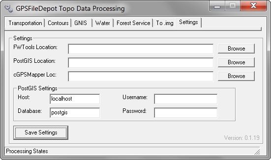
Over the past few years, Dan Blomberg has come up with a step-by-step process to generate high-resolution vector topographic maps (equivalent to 1:24K) for Garmin GPS units. There’s a multi-part tutorial describing the process on his GPS File Depot website, along with free downloadable maps created using this process by him and others. To simplify and automate some of the steps, he’s created a basic front-end called Topo Process. Feature list (from the website):
-
- Transportation – Download and process the 2008 Census data automatically (2008 data downloaded added in v1.0.15)
- Contours – uses FWTools to process the contours; also uses PostGIS; this is free and easy (GeoTiff Files Required)
- GNIS – points of interest; just like the program gnis_process; works until the usgs changes the file names
- water data – automatic parsing of the water data, read the directions in gray for how the folder needs to be organized
- Forest Service – VERY VERY BETA; I wouldn’t use it (i do but in debug mode)
- to .img – just point it to the folder with the .mp files and it’ll convert them all to .img
You’ll need to use the tutorial instructions to install all the required software packages (e.g. PostGIS, FWTools, cgpsmapper) before using the tool.

Currently written in VB6; Dan’s working on a version to be done in Java. I really need to move on from VB6 as well :).


