An earlier post in this series covered GlobGPS, a simple (and simple-to-use) Garmin vector map editor. GlobGPS has a built-in raster image calibrator, but the only calibration units accepted are latitude/longitude; if you have a map in UTM or some other projection, this can create calibration inaccuracies. For that matter, if you have a raster image that’s already georeferenced, e,g, GeoTiff, MRSID or BSB, it seems like a waste to have to re-georeference it again.
I’ve written a small program called GlobGPS Helper that will:
- Open a raster image with embedded georeferencing data; supported formats are GeoTiff, ERDAS Imagine, MRSID and BSB.
- Re-project the raster image to geographic/WGS84 (Plate Carree).
- Save the image in the JPG format that GlobGPS requires.
- Save a .cal file that GlobGPS can use to load and automatically geo-calibrate the file.
- Give you the option to save the re-projected raster image in GeoTiff format.
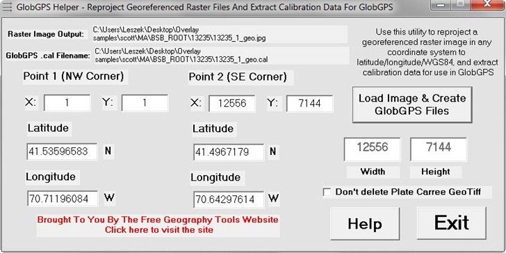
Simple interface; just click the “Load Image …: button to select the desired georeferenced raster image, and the rest of the process is automatic:

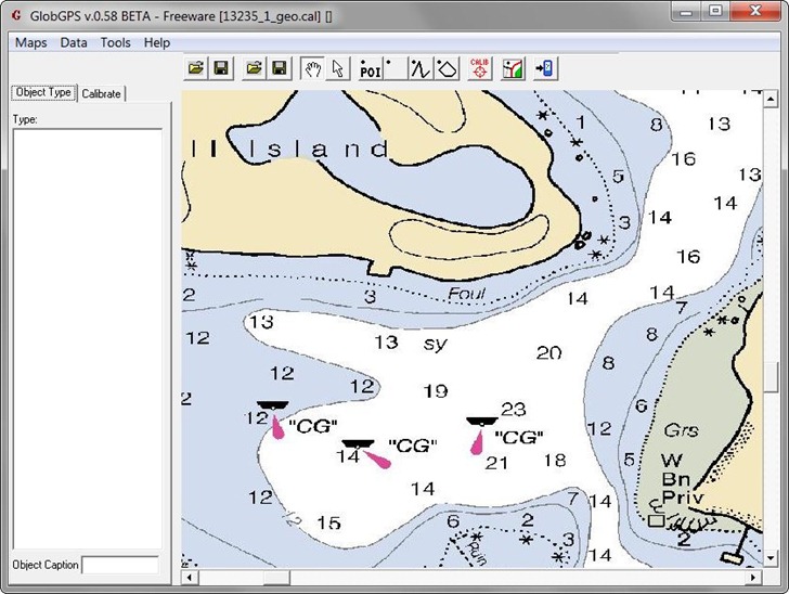
In this example, I’ve loaded a BSB navigation chart (loading the file 13235_1.kap). GlobGPS Helper uses the GDAL library to re-project the image into Plate Carree projection, WGS84, saves the image in jpg format (filename shown above to the right of the “Raster Image Output” label), and also saves the .cal calibration file that GlobGPS uses to load the jpg image and calibrate it:

In housekeeping files, GlobGPS Helper automatically deletes the re-projected GeoTiff file generated from the original raster image; check the box to the left of “Don’t delete Plate Carree GeoTiff” if you’d prefer to save it (it would be called 13235_1_geo.tif in this example). All the rest of the data shown is for information purposes only. The Help button takes you to this post page; Exit does what you would expect. There’s some error-checking, but it may not be foolproof; if you hit a problem, let me know.
Download the GlobGPS Helper application here; unzip the entire folder to your location of choice, and run the executable from that folder. As usual, verify the data before using it in your GPS, and use it at your own risk.


