The Earth Is Square posts about JSatTrak, a Java program to display satellite tracks and coverages in 2D and 3D. Huge feature list; from the website:
- Real-time and non-real time tracking modes
- Orbital elements for over 3,000 satellites which are easily updated
- Ground stations: 800+ built in and the ability to create custom locations
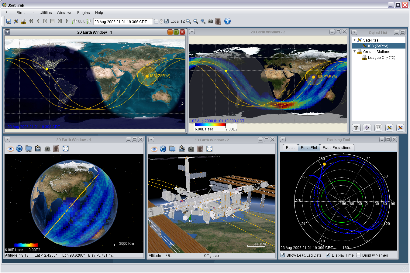
- Tracking tool – includes tracking angles, polar plotting, and pass predictions (visible and radar) with elevation constraints
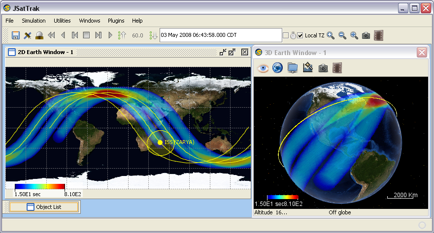
- 2D ground track display
- 3D globe with streamable high resolution imagery via NASA’s World Wind SDK
- Capture 3D animations
- Custom Satellites using a mission designer interface with solver loops to allow for modeling of maneuvers
- Custom high precision propagation – 4th, 8th, and adaptive 7-8th order Runge-Kutta methods
- XML saving/loading of scenarios
- Command console using BeanShell
- Plugin capabilities using bean shell scripts
- Remote command server (and client) for sending commands to the application remotely over a TCP/IP connection
- Earth Coverage Analysis (screenshot, movie) (v3.2)
- Create movies of any window or entire app (v3.2)
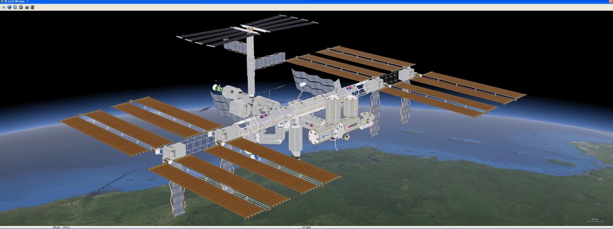
- 3D model loader and new model centered view mode (ISS example) (v3.5)
- Full screen exclusive mode for 3D windows (v3.5)
- Nimbus look and feel support (screenshot) for java 1.6 update 10 or greater (v3.5)
- More 2D map images and ability to load customized maps (v3.5)
- Added 2D Earth lights night image effect (v3.5)
- Run script without displaying GUI (v3.6)
- TLE data importing and user defined datasets (see the readme in data/tle_user) (v3.7)
Here are two orbital tracks and coverages for US GPS (random satellite in green), Glonass (random satellite in red:

And the same plot for the two prototype European Galileo GPS satellites:

Data is available for all US GPS, Glonass, Galileo and SBAS (WAAS/EGNOS) satellites, as well as the US Navy and Russian LEO systems; find them in the Satellite browser. Be sure to check out the screenshot gallery as well to get a feeling for what the program is capable of, but don’t bother download the .jst scenarios; they were created with an older version, and the new version doesn’t support this format.