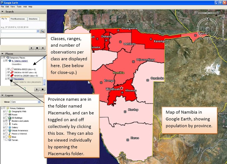
After yesterday’s post on thematic mapping in Google Maps, John Stewart of the University of North Carolina’s MEASURE program wrote to tell me about their own thematic mapping tool, the E2G Thematic Mapper. This Microsoft Excel macro spreadsheet data and links it with polygon data for countries and their administrative units to create thematic maps for Google Earth:

Image is from the excellent PDF manual included with the distribution. I can’t try it out because I don’t currently have a computer with Excel (2003 or 2007), and it doesn’t seem to run on Open Office Calc.
It also currently only has polygon data for sixteen countries:
- Botswana
- Côte d’Ivoire
- Democratic Republic of the Congo
- Ethiopia
- Guyana
- Haiti
- Kenya
- Mozambique
- Namibia
- Nigeria
- Rwanda
- Tanzania
- Uganda
- Vietnam
- South Africa
- Zambia
But John says that an update coming this summer will add polygon data for more countries, along with more macro features.
If you’re interested in field data acquisition, the entire Monitoring and Evaluation Systems section of the MEASURE site is worth a look.
Easiest solution is http://www.begraphic.com
the free version of this Excel addin lets you build dynamic maps from your data.
Business users (with professional email) receive 10 000 maps.
Thanks, but I’ve already covered BeGraphic :).
https://freegeographytools.com/2010/excel-add-on-for-map-and-data-visualization