Remy Paternoster writes to announce a new tool he’s created, an Excel app called KMLxl that imports a KML polygon/placemark file created in Google Earth, and lets you both attach data to each polygon and scale the height of the polygon to a variable value:
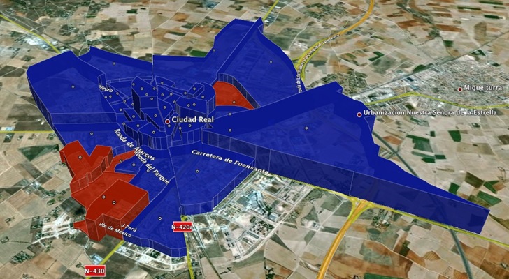
The process is straightforward, involving creating polygons and associated placemarks in Google Earth, importing the KML file into Excel with the app, adding data, and then exporting the results as a new KML file. You can update the Excel spreadsheet at any time with new data, and create a new KML that reflects the newer data. In addition to the app, Remy has an easy-to-follow step-by-step tutorial of the process in an accompanying PDF file.
I get nothing after I do the first import step.
You only should get a message that says the number of polygons you imported. You should see any data added to the sheets, I didn´t want it to interfere with your data, the import process creates a txt file right next to you excel file with the imported data…
Check the tutorial out to see the next steps and let me know if you have any more problems.
where downloads excel addin?