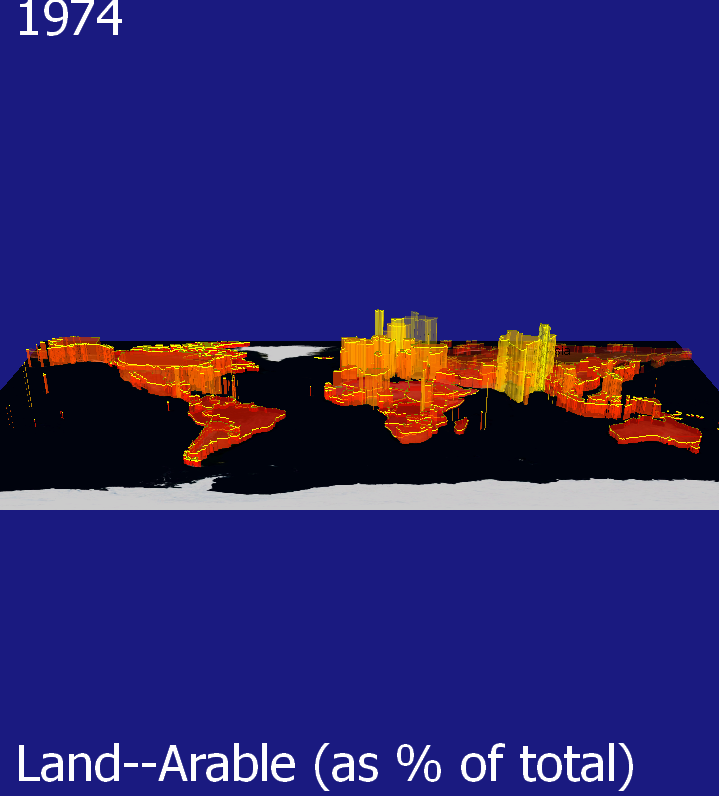
Monday’s post on the Thematic Mapping Engine reminded me that I’ve been meaning to post about Uuorld (pronounced “world”) for a while. Uuorld is also a thematic mapping tool, but uses its own custom 3D display engine instead of a standard digital globe or file format (like the TME’s use of KMZ for display in Google Earth or other compatible programs). It comes with roughly 120 or so datasets of demographic/commercial/land use data, which can be displayed for a preset world region, or for a custom region you can create yourself. Many of the datasets are time-based, allowing you to create animated prism or choropleth maps that can be exported in a number of video formats (mp4, mpg, avi and flv). Controls let you set the tilt and orientation of the 3D view, and export it as a TIFF, JPEG or PNG:
When I first heard of Uuorld, I wondered whether it made sense to have another 3D world program for viewing this program, instead of just creating data in formats suitable for the digital globes already out there (Google Earth, WorldWind, ArcGIS Explorer, Virtual Earth, etc.). But having played with Uuorld a bit, consider me a partial convert. The interface is intuitive and very easy to use, with all the features readily accessible . I didn’t really need to consult the help file at all, but the website has a number of teaching videos on how to use the program. The video export feature is nice, and I didn’t even touch the statistical/spreadsheet functions it has for advanced data analysis. Finally, it’s multiplatform, with versions available for Windows, Mac and Linux.
The only real drawback now is the lack of ability to import your own datasets; the website mentions that this ability will be coming soon, but doesn’t say whether the data importer will be available for free. If yes, this will be a useful tool for easy data visualization and analysis. If no, then you’ll probably only find it useful in the long run if the included datasets match your areas of interest, and are probably better off with the Thematic Mapping Engine. Addendum: Check the comments – an importer is coming soon. Thematic Mapping Engine is still worth a look, though, because it produces KML files for use in Google Earth.
Hey, I’m a UUorld developer. The next version will have a free importer. We really just wanted to test the interface on this round. Glad it worked out.
@Willy
We’re looking at UUorld even from Italy (take a look to the link)…
Glad to know that data import will be (hoping) soon implemented.
Your product is really interesting and innovative, personally I see great potentials in teaching.
Ad maiora!