Got an email from 192.com, a UK mapping website, announcing some new enhancements to the site:
- Ordnance Survey Maps with all streets labeled
- 12.5-cm resolution aerial photography
- Journey planner
The interface is Flash, proprietary and a bit small in size, but useable. I’ll defer to any UK readers as to the quality of the OS maps, but the aerial photography is very impressive. Here’s shot of Stonehenge at maximum zoom, clearly showing individual visitors:
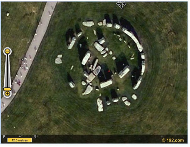
Note: There’s no separate settings for maps or aerial photography. As you zoom in, you first get OS Maps, and when you zoom in very close, it switches over to aerial photography. I tried three locations at random in the UK, and they all had high-res aerial imagery, so I’ll believe their claim that it covers the entire country.
192.com has other mapping service features, like people and address search, business search, local search, etc.. Doesn’t have all the capabilities of Google Maps, but the OS Maps and high-res aerial photography could make this a useful alternative to GM for UK residents.