Frank over at Google Earth Blog was nice enough to link to my post last week about GE-Graph. In his post, he describes another great Google Earth utility from the same author that I was also planning to post on, and here it finally is.
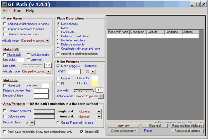
GE-Path allows you to take point data, either from a KML file, a spreadsheet, or entered manually, and create paths and polygons from them. Here’s the program interface:

And here are a few examples of its use. Suppose you enter two points in Google Earth, and want to create an equally-spaced or constant-distance grid between the points. Save them as a KML file (not KMZ), and open them in GE-Path. Check the box next to Make Grid, select the line color, and then the number of lines or the distance between lines (in kilometers). Choose Run, and the KML file will be created, and opened in Google Earth automatically if the checkbox at the bottom is set. In the example below, the two pushpins mark the original points created in Google Earth, and the grid was created specifying “10” as the number of lines:

By checking the Draw Path box, I can draw a line between these two points, and put arrow markers on the end of it; “Link last to first” closes the path if checked:

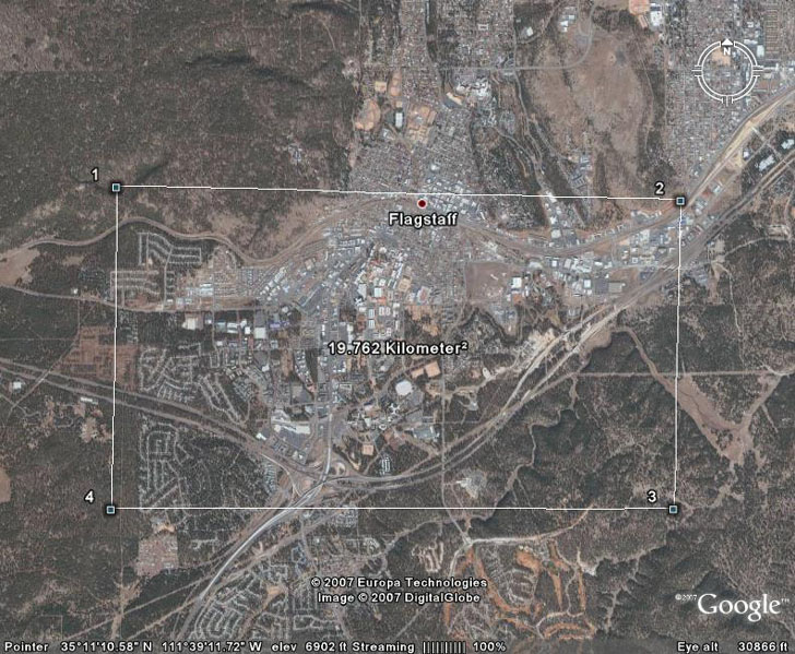
Creating a new set of four placemarks in Google Earth, I can connect them all into a polygon, calculate the perimeter and area of the polygon, and have the area displayed in the center of the polygon in Google Earth:

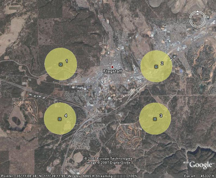
For the final example, I’ll check the “Make Polygons” box, and create polygons centered at each of the points above. The number of segments for this example is 50, which makes them look essentially circular, and the Length is 1 km (essentially the radius for the circle in this example; for a four-segment polygon, a square, it would be the distance from the point to a corner of the cube):

The full set of features (from the GE-Path website):
- Read kml file saved by Google Earth
- Link the placemarks (simple or arrowed lines)
- Add sequential numbers and/or append the coordinates to the placemark’s names
- Calculate distances between placemarks
- Calculate route (bearing) to the next placemark
- Add distances, routes and/or coordinates to the placemarks description
- Draw horizontal and/or vertical grids (equally spaced or not)
- Draw regular polygons around placemarks
- Calculate path’s length/perimeter
- Calculate the area delimited by several placemarks (or by path’s waypoints)
- Save the resulting kml file and export it to Google Earth
- Save data as txt (comma delimited)
- Copy from clipboard
- Export data to Excel
- Directly input data
- Edit data
- Fill polygon
- Use altitude for paths, polygons and place names/icons
- Automatic configuration (and restoration) of the system decimal separator
- Choice of width of the Path’s line and polygon outline
Could you let me know hows to paint area of grid square when i fill with data such like poverty??
sorry my english language not good
Thanks
Herry Kusmaiwanto
BPS Demak, Indonesia
I think that GE-Graph will do what you want:
https://freegeographytools.com/2007/plotting-data-in-google-earth-using-ge-graph