The previous three posts on 3DEM have dealt with its capabilities on 2-D display of three-dimensional surfaces. But it’s also capable of producing three-dimensional images and animations. Not just standard perspective views, but a variety of animated and interactive views, both in standard and 3-D anaglyphic (red/blue) formats.
When viewing a digital elevation model (DEM) in 3DEM, you will see a square with a notch in one side on-screen:
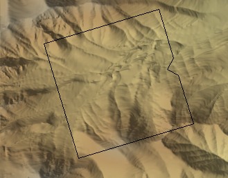
This square defines both the extent and direction in which the 3D view will be created. The notch indicates the viewer’s position, and it’s pointing in the direction of the view; the size of the square defines how much area will be covered by the 3D view. Clicking anywhere on screen will make the square jump to that point, and you can also click-and-drag to move it to the desired location. Click and drag on one of the corners of the square to both change its size and the direction of the view.
When you have the view set up the way you want it, choose Operation => 3D Scene (F2) from the menu:
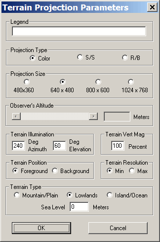
Legend: Titles the view you’ll be creating
Projection Type: Choose from color (standard view), S/S (side-by-side stereo views), or R/B (red/blue anaglyph)
Projection Size: The displayed size of the 3D view on your computer screen. You can save the final image in a larger format from the File => Save Large Format Image menu item in the 3D view
Observer’s Altitude: Set’s the altitude for “Background” terrain position (more on this in a bit); disabled for “Foreground”. For higher altitudes, the viewing angle points basically downward, and moves higher as you go to lower altitudes. Unfortunately, you can’t modify the viewing angle independently of the altitude.
Terrain Vert. Mag.: Sets the vertical exaggeration of the terrain. 100% means it’s scaled 1:1 with the horizontal scale, 200% would effectively double the heights of the terrain relative to the horizontal.
Terrain Resolution: Min for low resolution, Max for full resolution. The program is fast enough that Max is probably the best setting for all but the slowest computers.
Terrain Type: Use Mountain/Plain if no ocean area is visible, use Island/Ocean or Lowlands if ocean is visible. As in the previous post on viewing landscapes with different sea levels, you can also adjust the sea level here as well.
Terrain Position: “Foreground” creates a square representation of the terrain, like a cutout with the view; “Background” blows up the view to fit the entire window. Here’s a foreground view:
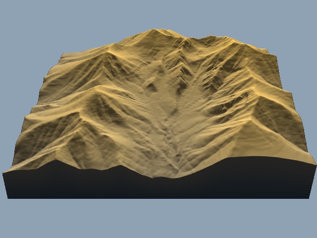
And here’s a background view of the same area:

With the Terrain Projection Parameters set, click OK. If you only have the shaded terrain visible, the Terrain Colors window will pop up to give you the option to modify the relief colors. If you have an overlay, the 3D view will come up immediately:
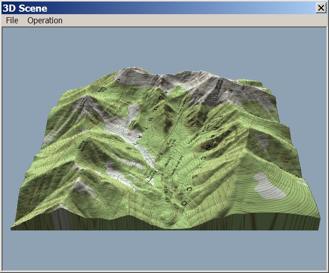
The File and Operation menus provide options like saving the image, printing it, modifying the Terrain Projection Parameters and shading colors, and so on. I’ll only talk about two of those options in this post. Operation => Change Position (F6) lets you tilt, rotate, and shift the position of the terrain you’re looking at:
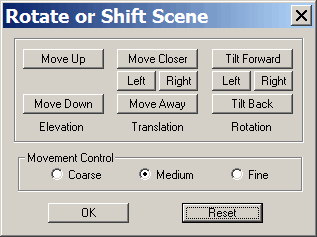
File => Save Rotation Animation lets you create a short AVI video file of the terrain as it’s rotated through 360 degrees. At 2 degrees per frame, and 30 frames per second, it’s a short video (6 seconds), but setting your video player to “Repeat” will make it loop over and over. Here’s a rotation animation for the terrain with a topo map overlay:
And here’s another rotation animation with a black and white aerial photo overlay, but also done as an 3D anaglyph; grab your red/blue 3D glasses for this one.
There are several more 3D features in 3DEM; tomorrow, I’ll talk about creating an interactive 3D VRML world using the program.