blankblank blank


Archive for the 'topographic maps' Category Page 6 of 6


Coordinate, Elevation, Distance And More In Google Maps

In an earlier post, I talked about a website that gives you coordinate data for a point in Google Maps. I’ve just found a website that gives you that information, and more, for any point within Google Maps.
Earth Tools offers up the standard Google Maps interface with position crosshair in the center, and a number of information options for the position marked by the crosshair:

  • Location: Click on this, and get the position both in latitude/longitude (decimal degrees and degrees-minutes-seconds) and the UTM coordinates
  • Height: Give the elevation of that location in feet and meters
  • Time: Gives the local time, and the time zone relative to Universal Time (GMT)
  • Sun: Gives the time for various twilights (Astronomical, Nautical and Civil), and sunrise/sunset
  • Distance: Click on the “Start Measuring” button, and scroll/pan the map – you will get the distance from the original crosshair position to the new one. Click on “Stop Measuring” when you’re done.
  • Places: Enter a place name to search for it from a database of 7.5 million names.

In addition to the regular Google Maps Map-Satellite-Hybrid buttons, there’s a fourth one called Contour that will supposedly overlay a high-resolution contour map on top of the Google Maps display. For my area, coverage wasn’t complete yet, more of a checkerboard pattern; YMMV.

The website also offers the elevation, time, and sunrise/sunset data via a webservice.


Mexican National Atlas

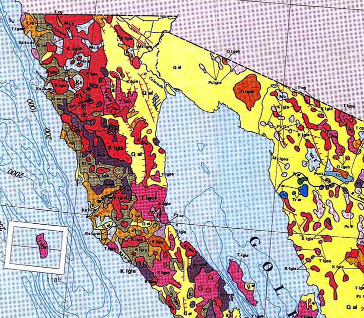
hablandodesigs links to the Mexican National Atlas, posted online by the National Autonomous University of Mexico’s Geographic Institute. Large-scale JPG scans of pages from the published volumes, slightly marred in some cases by not using de-screening during the scans. Map categories include General, Historical, Societal, Natural History, Environmental, Economics, and International Relations. En Espanol, of course, but even this gringo was able to make his way through the site and the maps. Here’s a subsection of one of the maps, showing the geology of the area around the northern Gulf of California.

Sample map from the Mexican National Atlas


Identify And Download USGS 24K Topographic Maps In Google Earth

Here’s a useful tool for identifying which USGS 24K topo quad covers a specific area in the US in Google Earth; it even gives you a handy link to download a GeoTiff of the map from the Internet Archive.

DDS Mapfinder is a KMZ file that opens up in the places pane in Google Earth. Read the warnings and instructions first before using it – if you try and open topo grids for all the states, you may crash Google Earth. Check on an index for a particular alphabetical group of states, and rectangular grids will open on top of those states:

Continue reading ‘Identify And Download USGS 24K Topographic Maps In Google Earth’


Updated USGS 24K Topographic Maps From The US Forest Service

1:24,000 scale topographic maps from the United States Geological Survey (USGS) are a convenient cartographic resource, readily available from regional state GIS agency archives or the Internet Archive / Libre Map Project. However, many of the maps are seriously out of date, as much as twenty years or more.

Continue reading ‘Updated USGS 24K Topographic Maps From The US Forest Service’


Free Soviet Military Topographic Maps Of Europe And Asia

After the fall of the Soviet Union, a large number of topographic maps covering much of the world became available in the West; the story behind these maps is told on the informative Soviet Maps website. There are dealers who will sell you sets of maps on CD or DVD, but there are also some websites that allow you to download some individual maps for parts of Europe and Asia for free.

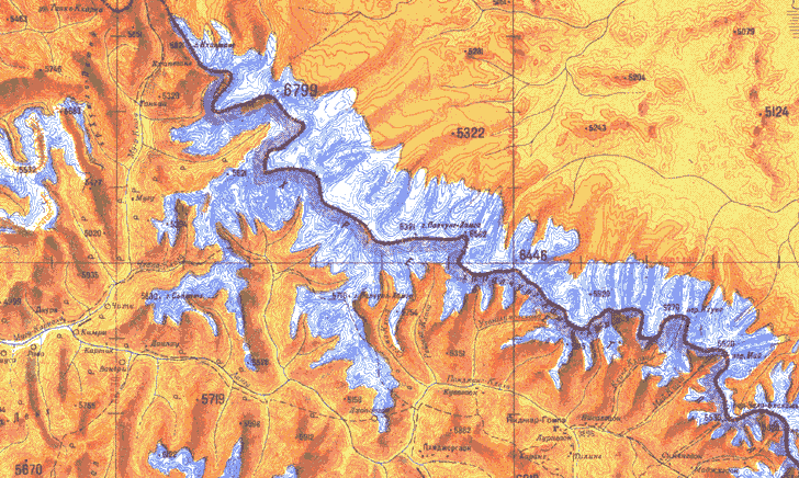
Some of the maps have a graphic style more colorful and visually appealing than many topographic maps from Western countries. Here’s an example of one of those maps, showing the Himalayas along the Nepal-Tibet border:

Soviet Army topographic map of the Himalayas

The Soviet Maps website has a few maps from England available for download, but there are far more available at two other sites linked to from there.

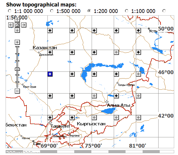
The Poehali website, connected with the MapStor dealers website, has a Google-Maps-based interface:

Poehali website interface for retrieving Soviet military topographic maps

Scroll and zoom to the area you’re interested in, and select a map scale you’re interested in at the top. Solid black plus signs in the map subsquares indicate that maps covering the entire subsquare at that scale are available; ghosted plus signs indicate part of the area is covered by available maps; minus signs indicate that no maps at that scale are available for the area. Click on the plus sign, and a list of links to those maps will appear below. Click on a link, wait a few seconds while you look at a MapStor ad, enter a numeric code, and you can then download the map in GIF format (not georeferenced).

You might also try ????? ??????? (Karta Ukraine?); it’s only in Cyrillic, so if you don’t read Russian (and I don’t), it’s kind of tough to figure out all of what’s available on it. From poking around the site, and from a very limited knowledge of Cyrillic, I can see that there are topographic maps and orthophotos (not georeferenced) for Ukraine, and apparently parts of Belarus and Moldova as well, in JPEG format. They also aren’t georeferenced, and you’ll have to do that to use them in a GIS program. Explore the site I’ll be posting about free georeferencing software and techniques in future posts.

Soviet maps don’t necessarily use the same symbology as Western maps. But you can download explanatory guides to Soviet topo map symbology from the Armchair General website or a Stanford Library website.