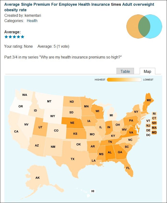
Take one of DataMasher’s 90-odd datasets (demographic, economic, energy, health, etc. data by US state), add/subtract/multiple/divide it by another dataset, and plot the results as a choropleth map (plus get the results in tabular form):

Mashups are posted publicly for comment and ratings. Results may be significant, or be totally devoid of meaning; YMMV. DataMasher makes no claims as to the statistical validity of any of the maps created. You can also select and plot individual datasets by themselves. There’s a short video on how the process currently works, and DataMasher promises more datasets and capabilities are coming.
I am wondering if you still have a copy of a program that you posted on the site a while back called “Micropath GeoCode”? I can’t find it anywhere on the web and would really love to see what it can do. Please let me know.
I do still have a copy. But since the program’s original authors appear to have withdrawn it from free public availability, I don’t feel it’s appropriate for me to distribute it. If you search the “geocoding” category on this blog, you’re likely to find other applications that do something similar.
What did you use the program for? Did it work well? I am looking to find a program that will reverse geocode very large batches of points into addresses (like 5000-10000) and the quicker the better of course :) And even better would be a program where I could select an area (like a square mile) of residential neighborhoods on google maps and then press a button and it would spit out all of the addresses within the selected area. Would that program be suitable for that use or do you by any chance know where I could find something that could do that? Thanks in advance :)
I did a little bit of sample geocoding to test it out, but not much more than that. You should find some reverse geocoding programs with a search on this blog that should do much of what you want. I don’t know of any programs/sites that will let you select an area, and come back with a list of addresses.