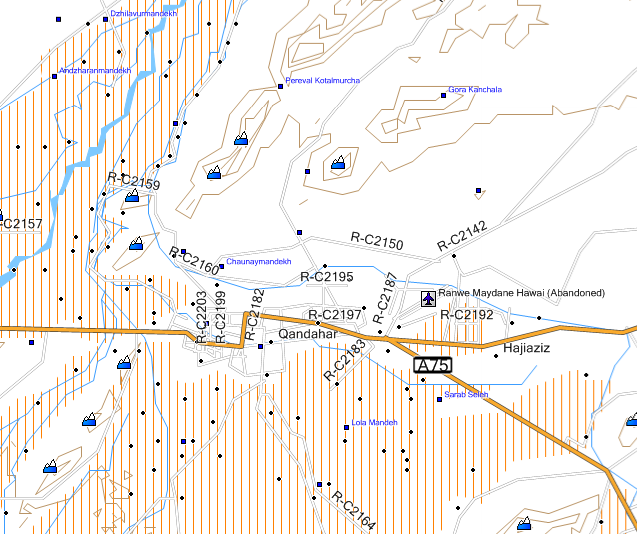
Just noticed on the GPSFileDepot site that they’ve started posting 20-ft.-contour topographic maps for Afghanistan for Garmin GPS units, created by Steakhouse Studio. Here’s a MapSource screenshot of the Kandahar area:

Twenty-five topo maps are currently available, covering one-by-one or one-by-two degree quadrangles; by my best estimate, this covers roughly a half of Aghanistan’s territory, but it looks like new maps are being added on a regular basis. The link page also include road maps for Afghanistan as a whole, and for metro Kabul.
Also at GPSFileDepot is a Garmin topo map for the Baghdad, Iraq area, with 20-ft. countours, roads and points of interest. Plus, there’s a permanent download page for the routable Garmin map of Baghdad mentioned in an earlier post.
Windows and Mac installers available for all these mapsets.
Addendum (5/22/2009): An upgraded set of these maps is available for US Government use only; contact the author for info.


i need the helmand province in afganistain for a gps navsystem for bushnell ..onix 200cr
Sorry, but you’re pretty much out of luck. Nobody except for Bushnell is providing maps for that model.