18,000 years ago, at the height of the last ice age, much of the Northern and Southern Hemispheres were covered by ice, and the climate and ecosystems were dramatically different. The Review And Atlas Of Palaeovegetation has links to maps and web pages describing the changing climate from 18,000 years and more ago.
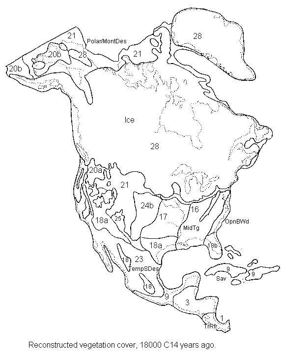
The original datasets included maps from 18,000, 8,000 and 5000 years ago. Here’s the map for North America from 18,000 years ago (click on the image for a larger version):

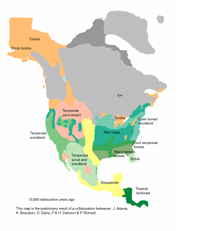
Updates to the data include maps from earlier on, and at shorter intervals; here’s the map for North America from 13,000 years ago, showing the “ice-free corridor” through Canada that some archaeologists believe was the path that humans first took to colonize the rest of the Western Hemisphere from Alaska:

You can look at these maps as showing the effects of extreme global warming on the distribution and extent of ecosystems, changes we may see echoed in the distribution and extent of modern ecosystems as temperatures rise over the next few hundred years.