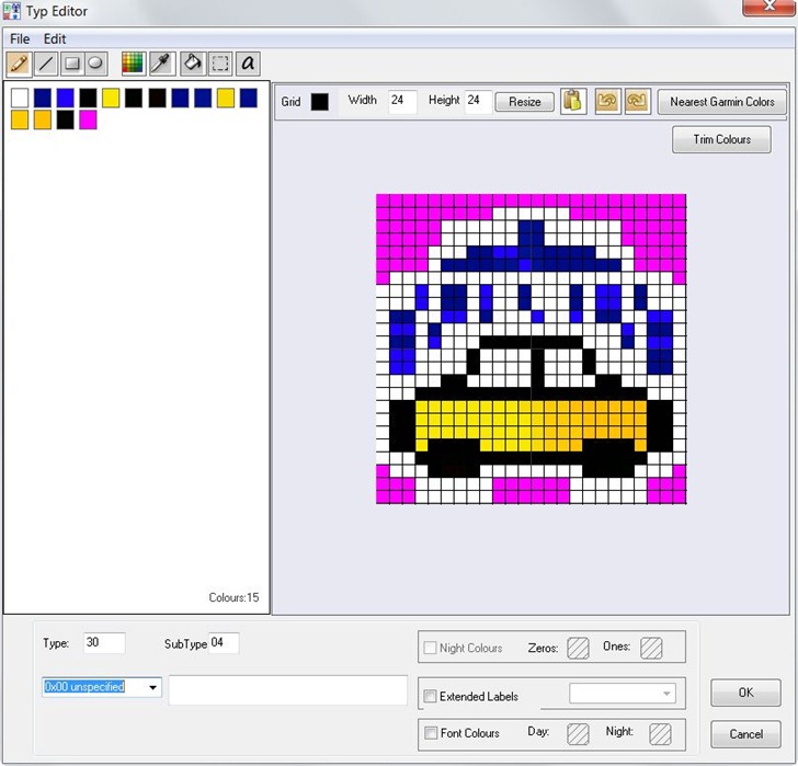
I’ve done a long series of posts on this site about various tools you can use for creating custom vector maps for Garmin GPS units, one of the most powerful features for these models (even if Garmin itself doesn’t directly support it). One especially powerful feature is the capability to create your own custom point, line and area symbols for these units, either replacing Garmin’s default symbology or creating new types for use in your own map. It’s not a trivial process, and while I’ve covered a number of tools that help somewhat with creating custom symbology here and here, all of them have been lacking a bit in functionality and ease of use. But I’ve now dumped all of them in favor of a new tool I’ve found: TypWiz. You’ll still need to learn something about what TYP files are and how to use them, but TypWiz dramatically lowers the difficulty barrier for creating and editing them.
- Loads in existing TYP files for editing, in either text or compiled TYP format
- Saves TYP files in either text or compiled TYP format (latter requires cgpsmapper to be installed on your system)
- Creates point, line and polygon symbology, with complete control over type and subtype, draworder
- Easy-to-use graphic symbology editor

- Optionally converts your selected colors into the nearest 8-bit color equivalents for older Garmin models, i.e. the previous OS used in the 60C and color eTrex models. Newer models use a wider 16-bit color range.
- Code section shows TYP file text code for that symbol; changes in the graphic editor show up automatically in the code section, and vice versa.
- You can also save graphics from the editor as bitmap files, for use as custom POI icons or custom waypoints on compatible Garmin units. Note that these are saved in 24-bit BMP format; older units require 8-bit BMP files with 96-dpi resolution.
- Short but very clear program manual.
You should also poke around the main OSM Tools site, home of TypWiz, as there are a bunch of additional utilities worth checking out:
- MapSource Uploader – A program to help install OSM-based Garmin maps into MapSource/BaseCamp.
- Route Editor – GUI to create custom Garmin routing styles
- mp2osm – GUI for converting Garmin mp files into OSM format (only works for non-copy-protected files).
- img2typ – Takes a compiled Garmin map in .img file, extracts all POI/line/polygons types, and creates an editable TYP file that lets you customize that map.
- … and more
Latest version, TYPWiz 2, saves TYP files independent of cgpsmapper and is the only TYP editor to cater for pois with sizes up to 48×48 and in truecolor including degrees of opacity .