I posted version 1.0 of my utility TritonRMP Helper on this site a few weeks ago, an aid to creating custom raster maps for the Magellan Triton GPS series. It re-projects a GeoTiff to geographic/WGS84 coordinates (if necessary), then extracts out the calibration data needed by the program TritonRMP Maker to convert the TIFF file into a Triton-compatible RMP file. I’ve added a few enhancements to it, and voila, version 2.0. Check the original post for basic info, but here are the improvements:
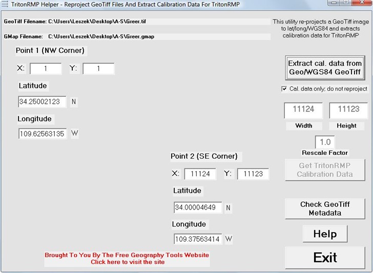
- The biggest change is in exporting calibration data to TritonRMP Maker. In 1.0, you had to manually copy the coordinates of calibration points into the program. Version 2.0 of TritonRMP Helper now creates a “gmap” file containing all the calibration data needed by TritonRMP Maker; no more manual copy-and-paste required, which cuts the time and work required a lot. Load the gmap file into the Maker program with the File => Map => Import Maps command. You can load multiple gmap files at the same time to combine maps, or different zoom levels, in the final RMP output. The name of the gmap file is displayed at the top of the program, along with the GeoTiff file associated with the calibration data:

- Version 1.0 allows rescaling of GeoTiff images down to smaller sizes, for use at lower zoom levels, but this sometimes fails without warning for very large images. Version 2.0 checks for this failure, and gives you an error message. You can sometimes get the rescaling to work by exiting the program, then starting it up and trying again.
- Version 1.0 came with no install program, just a zipped folder containing the executable and associated files. Some people were reporting issues with the “comdlg32.ocx” ActiveX control being missing on their system, and some would probably prefer to have a regular program install. So the program is now available in two versions: an executable for a full install, and a zipped folder version for those who don’t want the full install.
Standard disclaimer, i.e. use it at your own risk, and double-check any maps you produce for accuracy. And report any bugs you find to me via my Contact link.