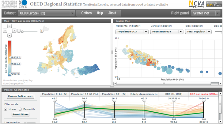
In the same vein as the StatPlanet app covered last week come another site for world demographic and economic data presented in a Flash map interface. The OECD Regional Statistics sites (Level 3 for small-scale data) :

There’s a limited number of plottable datasets (about 17), but the interface is terrific, perhaps the best I’ve seen for a site of this type. It was constructed using the Geovisual Analytics Visualization (GAV) Flash toolkit being developed at Linkoping University in Sweden. The data can be exported by selecting “Raw Text Data” from the dropdown menu at the upper right, and then copying/pasting the data into a text editor or spreadsheet; even more data is available from the OECD.Stat Extracts website.