The US Government’s National Oceanic And Atmospheric Administration (NOAA) has placed online 21,000 maps, downloadable in both JPG and MRSID high-resolution formats (see this post for several free MRSID viewers and converters). The maps are mainly historical nautical maps dating from 1655 to 2001, but there are also a fair number of Civil War battlefield maps, many of them contemporary with the war, and not all of them nautical in nature.
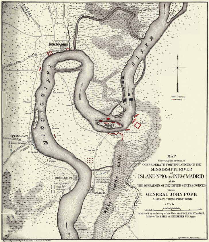
Map Showing the System of Confederate Fortifications on the Mississippi River (1862)
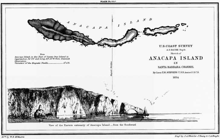
Charts are searchable by state, year, type and keywords; instructions for use are here. Other maps of interest include an extensive set of maps for Washington, DC, including the re-engraving of the 1792 L’Enfant and Ellicott plan for Washington D.C, and an 1856 map of Anacapa Island off California with a perspective view by the noted American artist James Whistler (no sign of his mother).
Cool maps! But, this is what I get when I click the link:
“Sorry for the inconvenience.
The web site http://historicals.ncd.noaa.gov is temporarily down…”
Were any of the maps you were able to access georeferenced?
Site was up two days ago – presumably, it will come back soon.
None of the maps are georeferenced; I hope to cover a number of georeferencing programs in the near future.
The historical and nautical site moved to a new URL – the post has been updated to reflect that.
Hi, On your webpage I could not type one keystroke for event, year, etc., nor could I pull down to select a state, nor could I click on & download any of your sample river maps. It’s like your info is avail. to look at but not interact with. Is it frozen?
How can I download a map when your webpage doesn’t seem to be working & I can’t type anything in your query fields?
First, it’s not my page, I only wrote about it. Second, you’re probably trying to type into the boxes on the instruction page, when that’s just a graphic image, not an actual form; same thing for the links you’re trying to click on, it’s just a picture. Finally, it appears as though the actual site with the maps is currently down, so you’ll have to wait until it’s back up again to try it.