Many raster image formats commonly used in GIS applications have metadata embedded in them that georeferences the pixels (assigns them a coordinate location), and often includes other information like the coordinate system, origin, and datum. Some GIS programs will let you view some or all of this metadata, others won’t. I’ve written a simple GUI front-end program for the GDALInfo utility that will extract the metadata from a compatible image file, display it, and save it in a text file. Download the program folder here, and unzip it to your desired location; keep the executable and the GDAL subfolder in the same folder, otherwise the program won’t work. No installation required, just run the program. Choose the raster image file you want with the “Open File And Read MetaData” button:
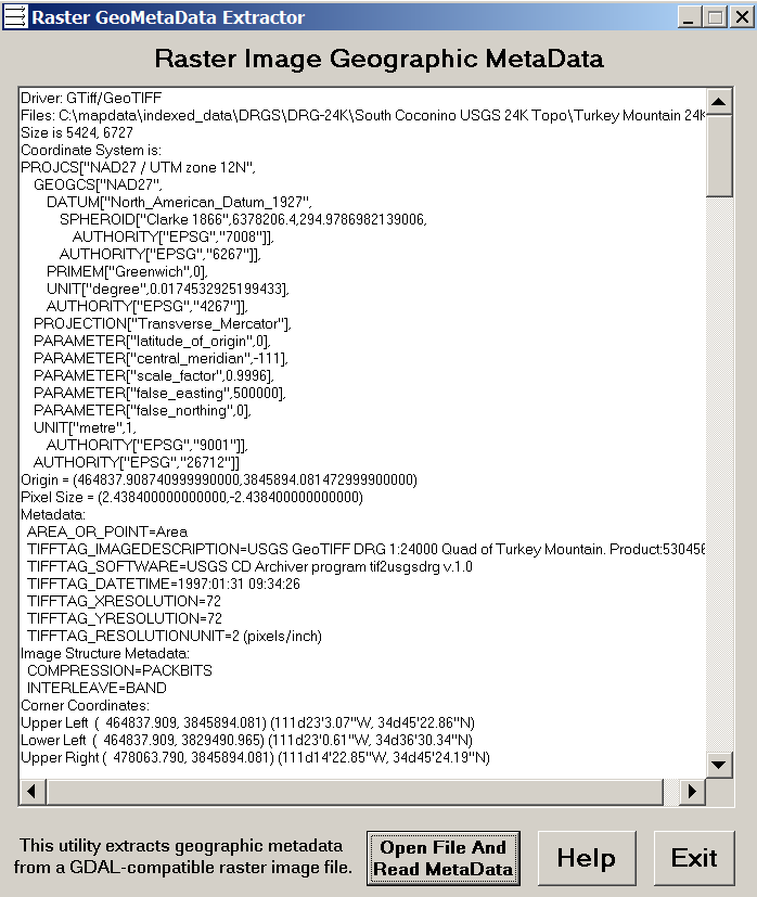
In this example, GDALInfo has extracted the metadata, and also basic image parameters, from a GeoTiff file called “Turkey Mountain 24k.tif”. You can copy the metadata from the text box for pasting elsewhere, but a text file containing all this information called “Turkey Mountain 24k.metadata.txt” has also been created. The “Help” button brings you to this page, while the “Exit” button ….
The program has been tested with GeoTiff (.tif, .tiff), MRSID (.sid), ECW (.ecw), JPEG2000 (.jp2,,j2k), and BSB (.kap) raster image file formats. However, it should run with any raster image format supported by the GDAL library, and I’ve included all the file extensions I could find for those supported formats. If you find a file format that GDAL supports, but which this utility doesn’t open, let me know what the file extension is and I’ll add it. If you find a GDAL-supported format that it doesn’t seem to work with, let me know that as well. The GDAL library is very reliable, but as usual, use it at your own risk.
split raster?