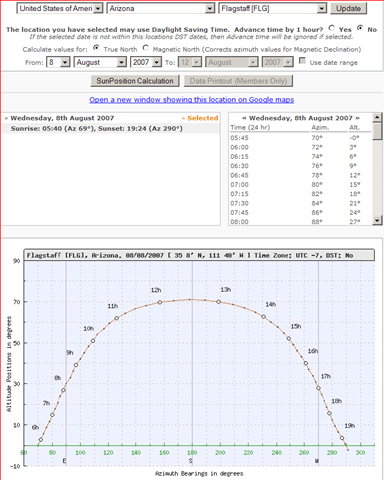
Select a geographic location by continent, country and city, and SunPosition.Info will give you a table of the sun’s azimuth and altitude during the day, as well as a plot of its position in the sky:
The stand-alone application MicroDEM can generate similar data, and if you have a digital elevation model (DEM) loaded, can tell you if the sun is blocked by local topography.
I was looking for just this kind of tool when I was writing my Pilobolus post (reposted two days ago).
This is a great tool, although there is only access to 7,900 locations as a non member, members get access to 48,000 locations and can even calculate for their own coords. Lots more information on the calculation printout available to members also. I jut discovered the printouts can even be printed in French, Spanish and German although the website is only in English
Good tool for solar energy professionals