Quite a while ago, I posted about Digipoint, a website that let you plot points in Google Maps automatically get the coordinates of the points, and export the data in text (TXT), AutoCad (DXF), comma-separated values (CSV), BLN (Golden Software blanking format) and tab-delimited (TAB). The Digipoint website has been upgraded to version 2 since then, enhancing the old features and adding new ones:
- Export in KML, GPX, and shapefile formats has been added to the previous export options listed above
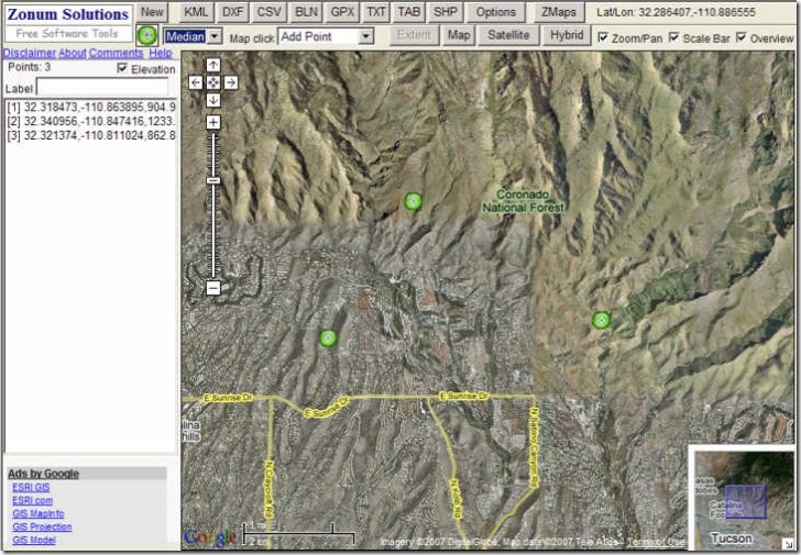
- Selectable icon shapes and sizes (Small, median, normal and big); click on the icon image to change the icon shape, choose the size from the drop-down next to it
- Four map-click options:
- Add point
- Delete point (new)
- Edit label (new)
- View elevation (new) – click on a point on the map and get the elevation
- Check the elevation box, and as you add points to your list, the elevation will be added as well
- An instantaneous readout of the cursor coordinates as you move it over the map display
- A separate “Options” button to set coordinate systems (lat/long. or UTM) and elevation units (meters/feet)
Hello,
I’ve been looking into google maps. I want to try and set up some code so that i can add points to my map automatically. i.e. if a user on my site registers a location, i want that to become a point on the map.
Does anyone know if this is possible?
I know how to embed maps and add points, etc, but to actually add points to MyMap automatically, not adding each point by hand. Tricky!
Any ideas?
I should add that I want to add points to a publicly visible map – points to be stored by google – not a temporary map on my server.