I’ve posted before about how to convert shapefiles from one coordinate system/datum to another. But I sometimes have the need to convert individual coordinate points, or text files with sets of coordinate points, from one coordinate system and/or datum to another. This post is the first in a series on freeware coordinate converters.
The first program is a highly specialized one that only handles NAD conversions within the United States. CorpsCon 6, from the US Army Corps Of Engineers, handles conversions to, from and within the NAD27 to NAD83 datums for geographic coordinates, UTM coordinates, state plane coordinates (SPCS), and the US National Grid Reference System (NGRS); it can handle both horizontal and vertical datum conversions. Conversions can be done for individual points, or batch conversions for text files in either a standard Corpscon format or a user-defined format.
Download the program version you need from the CorpsCon website. The largest version, at 104 MB downloaded, includes horizontal and vertical datum data for the continental US and Alaska, while the smallest (6 MB) only does horizontal conversions within the continental US. After installing and opening the program, the first step is to define the input and output coordinate systems. From the “Convert” menu, choose Setup, and select the appropriate coordinate systems you’re converting from and to:

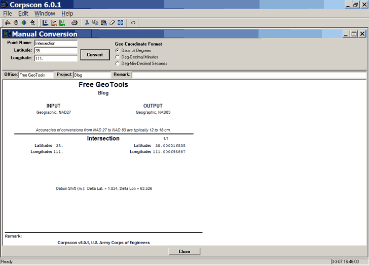
For individual point conversions, choose “Manual Conversion” from the “Convert Menu”. You can now enter data points and an identifying name into the appropriate boxes, and click “Convert”. Note that Longitude should be entered as positive; since the program is designed for use only in the Western Hemisphere, only positive west longitudes are acceptable. The conversion results will be shown in a window:

As you convert more points, the results will be appended onto previous results. You can then print the results, or save them in either a CorpsCon data format, a Windows Metafile (WMF), or as an HTML table.
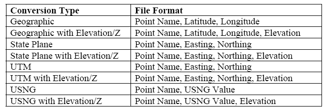
For sets of coordinate data in text files, there are two procedures you can use to do a batch conversion. The first one requires you to have your data in one of a number of different standard CorpsCon data formats, which will have to match the Input coordinate system defined by Setup:

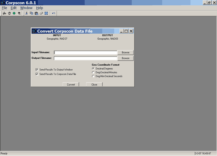
Select Convert => CorpsCon Data File from the menu, enter the input and output filenames, and CorpsCon will do the conversion and create an output file in a CorpsCon text data format:

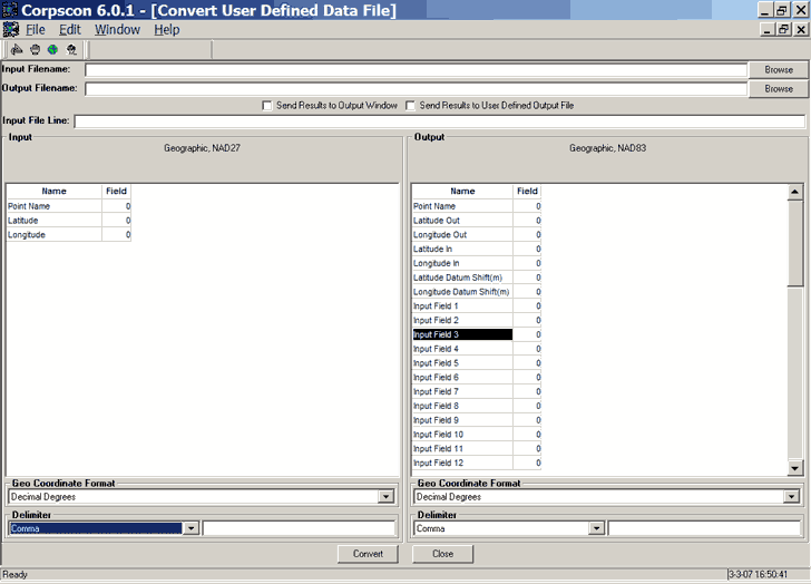
But if you already have data in your own format, along with additional data fields, CorpsCon lets you use those as well. Choose Convert => User Defined Data File, and CorpsCon brings up the following window:

Here, you define how the text in the input file is delimited (Comma, Tab, Space or Other), and which fields in the input file correspond to the ID and position coordinates. You can also define which of the input fields will be included with the converted coordinates in the output fields, along with the field delimiter.
CorpsCon is easy to use, and comes with a short but complete PDF User’s Guide as part of the install. For NAD conversions within the United States, I know of no other program as comprehensive, accurate and easy to use as this one. But it doesn’t handle conversions to other datums, like WGS84, other general coordinate systems (Lambert CC, Albers EA, etc.), and doesn’t work for the rest of the world. But there are free options for that ….