Bruce Ralston, author of the free TIGER to shapefile conversion utility tgr2shp, has a new program called tgr2kml that converts US Census TIGER file polygons (but not points or lines) into KML files. It works on TIGER files from 1994 to 2006 Second Edition (future TIGER data will be issued directly in shapefile and web formats).
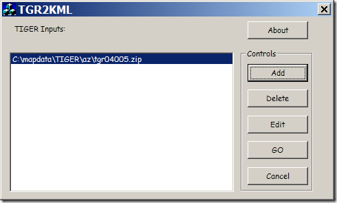
First select the TIGER files you want to process (they can be in zipped format):

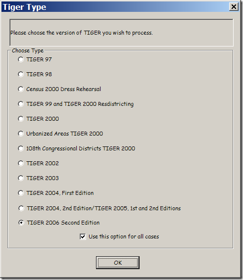
The first time you select a file, you’ll be asked which format the data is in (typically by year); all subsequent files need to be in the same format:

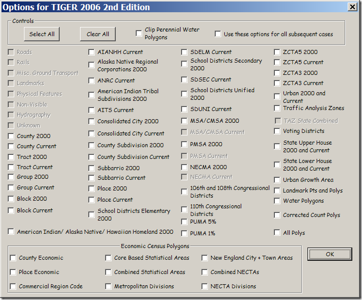
Then select the polygons you want to create a KML file for; a separate KML will be generated for each type:

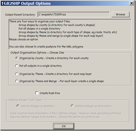
When you’ve selected all the files you want, click “Go” in the top window. You’ll have the option to specify the output directory for the KML files, and also how to organize the data (by county, theme, or all together):

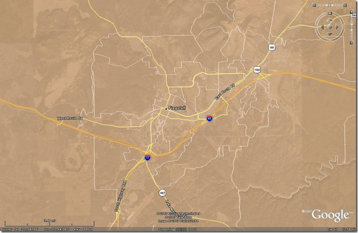
Click OK, and the selected polygons will be converted to KML files, like this one for voting districts:

Other posts in the Google Earth Data Tools series
- KML Editors
- Diagramming In Google Maps And Google Earth With Smoot
- Plotting Data In Google Earth Using GE-Graph
- Drawing Grids, Paths And Polygons In Google Earth Using GE-Path
- Online Google Earth Utilities For Buffering And Area Calculations
- Easy Display Of Thematic Data In Google Maps And Google Earth
- Using GIF/PNG Transparency In Displaying Raster Graphics In Google Earth
- Adding Vector Graphic Objects To Google Earth
- Animated GIFs In Google Earth
- Creating A Network KML Link To A Google Spreadsheet
- LIDAR Tools
- EarthPlot Software Tools For Google Earth
- Geographic Time Animations
- Convert TIGER Polygons To KML Files
- Putting Time Data Into A KML File
- Using The KML Time Embedder To Stamp Time Data Into A Google Earth File
- Using The KML Time Embedder, Concluded
- KML Time Embedder Improved With Hour-Minute-Second Ability
- Grid Creation And Path/Polygon Measurements: Two New Online KML Tools
- Google Earth PhotoOverlay Tool
- KML Random Placemark Generator
- Update For Online Google Earth Utilities
- KML Time Code Utility
- Screen Overlays In Google Earth
- The KML Screen Overlay Maker Utility
- KML Screen Overlay Maker Utility, Concluded
- KML Circle Generator
- Creating Google Earth Screen Overlays With EarthPaint
- Text Editor With KML Validation
- Online Spreadsheet To KML Converter
- Version 2.0 Of Google’s Online KML Spreadsheet Mapper Tool Released
- Creating Google Earth Ground Overlays From Georeferenced Images
- Google Earth Ground Overlays With GIF Transparency
- Creating "Transparent" Topo Map Overlays For Google Earth
- Using Google Earth Ground Overlays To Display Shapefile Data
- Converting 3D Objects Into Google Earth Format
- Thematic Mapping In Google Earth
- An Online KML Validator
- Modify A KML Polygon File With Excel Data
- US Nautical Chart Overlay For Google Earth
- Plot Google Analytics Geographic Data In Google Earth/Maps


0 Responses to “Convert TIGER Polygons To KML Files”