Shapefiles can be created in any coordinate system, and are often (and annoyingly) found in a coordinate system different than the one you’d like them to be in. For example, several of the shapefile to KML converters posted about recently require that the shapefile be in Google Earth’s native coordinate system: geographic coordinates (latitude/longitude), WGS84 datum; what do you do if your shapefile is in a different coordinate system, like UTM, Lambert Conformal Conic, or State Plane Coordinate System? There are lots of free conversion utilities out there that can reproject shapefiles from one coordinate system/datum to another, but there’s one I prefer because it’s fast and easy to use.
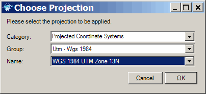
MapWindow is not only a first-rate open source GIS editor and viewer, but it also comes with a number of useful plug-in utilities, including one to reproject shapefiles to virtually any coordinate system and datum. After downloading and installing the program, you’ll have to enable the appropriate plug-in: go to the Plug-ins menu and select the GIS Tools listing on that menu to enable it. A new GIS Tools menu heading will appear on the toolbar. From that GIS Tools menu, select Vector => Reproject a Shapefile. Select the shapefile you want to re-project, and you’ll get the window below, from which you can select your target projection and datum:

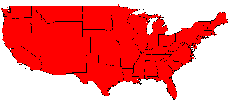
If the shapefile you’re reprojecting has a .PRJ projection file defining its original projection, MapWindow will read that automatically. If not, you’ll get another window similar to the one above asking you to specify the original coordinate system of the shapefile. MapWindow will then reproject the shapefile, and create a new shapefile with “_Reprojected” appended to the original shapefile name. Here’s a map of the US created from a shapefile in geographic coordinates:

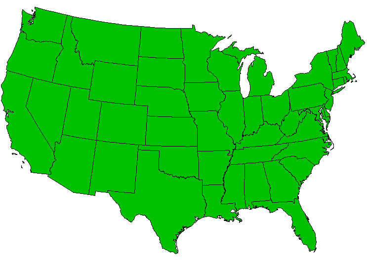
And here’s a map made from that shapefile reprojected by MapWindow to Albers Equal Area Conic:

In addition to the standard .SHP, .SHX and .DBF files, MapWindow will also create the .PRJ projection file for the newly-reprojected shapefile, which many GIS programs can read automatically, and which is useful to keep with the shapefile to keep track of its coordinate system. If you only want to create a .PRJ file for a shapefile, you can do that, too. Select GIS Tools => Vector => Assign Projection to Shapefile, and follow a similar procedure to the initial steps above to select the shapefile and its original projection; MapWindow will create a matching .PRJ file to go with it. Simple, fast and easy.
Thank you
Lot of people are working in GIS field they really need free support. So, its fine.
Thank you
Lot of people are working in GIS field they really need free support. So, its fine.
For the life of me, I can’t figure out how to get this plug-in to convert my files from UTM to latitude/longitude. I go through the steps and pick what I believe to be the right systems, but they still come out as UTM. Any ideas? Or is there another way to do this conversion?
Disregard; I figured it out.
thanks
But how can you guess what is the original coordinate system ? And what coordinate system does Google Earth use exactly ? (I understood that it was Geographic Coordinate but which group and name ?)
Good question. If the shapefile came with a .prj file, or with metadata, you should be able to find it there. If not, you’ll need to go to the source to find it out.
Google Earth uses unprojected latitude/longitude, WGS84.
is it free? i can’t download it.
MapWindow is completely free; just tried downloading it and it worked fine.