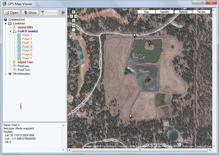
The stand-alone GPS Map Viewer plots points and paths from a KML or KMZ file in a Google Maps view. While you can do this with any number of online apps, including the My Maps feature in Google Maps itself, the GPS Map Viewer offers a couple extra functions not available in some of those.

- Get a list of all the individual points in a KML path in the info pane at left. Clicking on any of them, or on a individual waypoint, will bring up their position info in the bottom left pane, where you can copy and paste it somewhere else.
- Move the cursor over any point plotted at right, and its name will show as a pop-up
- Double-click on any path point to highlight it in red, and re-center the map on it; same effect by dragging and dropping a point from the list onto the map.
- Clicking on the small vertical red line brings up a toolbar

Functions from left to right are to save the view as a JPG, Print Setup, Print Preview, and print the map view with plotted data directly. You can drag and drop this toolbar anywhere it’s convenient.
Here’s a YouTube video demonstrating the program: