SM asks if I know “any free or commercial data source for boat landing or (boat ramp) sites…? I am especially interested in IL,IN,OH,and MI area.”. My first idea was to check two US Government sources of marine GIS map data.
NOAA’s ENCDirect To GIS Viewer lets you select a US coastal geographic area, then convert Electronic Nautical Chart data (ENC) to a wide variety of formats, including shapefiles, AutoCad, Google Earth, ArcINFO, MapInfo and many more. But selecting the data is a bit of a chore.
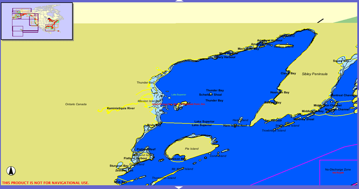
First, you select an area:

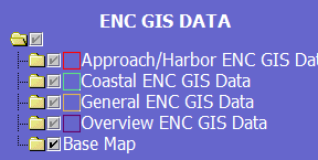
Then, on the right-hand-side, there’s a list of available data layers:

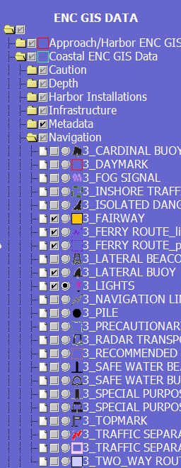
Click on a layer to expand it to reveal all of the individual layers:

There doesn’t appear to be a way to search for the location of a specific set of data, so it may take a while to find what you’re looking for.
Click on the circle next to the name of the feature to make it the active layer; in the above picture, Lights is selected as the active layer, indicated by the filled-in circle. The checkmark indicates whether that feature is being drawn in the current map display.
On the left is a toolbar:

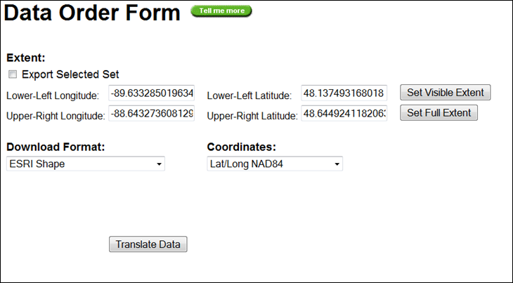
Click on Extract, and a new window will come up to let you set the data file type and coordinate system for the extracted data; you may have to enable pop-ups for this site to see it.

Default coordinate limits were defined by the area you selected (the “Visible Extent”); “Set Full Extent” will download all data available from the NOAA, which is likely to be huge. Use the dropdowns to define the data file type and coordinate system, then click “Translate Data” to generate the data in the desired format.
For inland waterways managed by the US Army Corps Of Engineers, try the Inland Electronic Navigational Charts data site. Coverage is primarily for the Mississippi River drainage system and the Gulf Coast; data is available in both shapefile format, and the ENC format used by some navigational software. Fugawi has a free viewer for this data, as does Caris, GlobeNav and PolarNavy. There’s a graphical data selector for the ENC data, but it doesn’t seem to work correctly with the most recent version of Java installed on my computer; fortunately, you can also select data using a text table checklist.
Having gone through all that, and looking at the data from both of these site, I found that none of these resources appear to contain the boat ramp data that SM was looking for – oops. However, a search for GIS boat ramp data in Google turned up GLINDA, a clearinghouse for GIS data for the Great Lakes area, and it does have the boat ramp data that SM was looking for in shapefile format. And for more general boat ramp data, there’s LaunchingRamps.com, which has links to state and federal agencies that may (or may not) have the data in GIS format. If the links at LaunchingRamps don’t have the info you need, a Google Search for “boat ramp”, GIS, and the name of the state you’re interested in might be the best option.
Leszek:
Thank you very much for informative post. It looks like launchingramps.com contains some information about which agency to contact about such data. This is plenty helpful. :-)
Thank you very much.
Sagar
The folks at earthnc.com have a free database (kml based) of boat ramps in Florida viewable in Google Earth.
Rich
ActiveCaptain has the largest database of boat ramps in the world. Every state in the US is covered and viewable over maps and nautical charts (coming soon – preview available in X Preview tab). Many other ramps are available throughout the rest of the world.
In addition, ActiveCaptain has tens of thousands of marinas, anchorages, bridges, inlets, and many other type of markers for boating use. It was just given SAIL Magazine’s Pittman award for innovation in electronics for 2008 (February 2009 issue).
Hi Jeffrey:
ActiveCaptain is a very cool application, Great Job!!
Wondering if the data is available for download free or paid?
Thank you,
Sagar
LaunchingRamps looked promising, but didn’t have the (very similar, but for Washington, especially Seattle) data I was looking for.
I’ve been slowly building my own database for Lakes Union and Washington, by marking waypoints when I get to a public dock. This is only so helpful; once I arrive there, I tend to remember the launch point fairly well. But the waypoints allow me to get distances and the like, which is harder to guess at without GPS help, especially when I’m busy in the kayak.