I’ve posted previously about Tom Patterson’s shaded relief maps, and he has a new one out. The Physical Map Of The World extends out his earlier Physical Map Of The Coterminous United States to cover the entire globe with shaded relief topography, “natural” colors to represent biomes, and key physical features labeled:

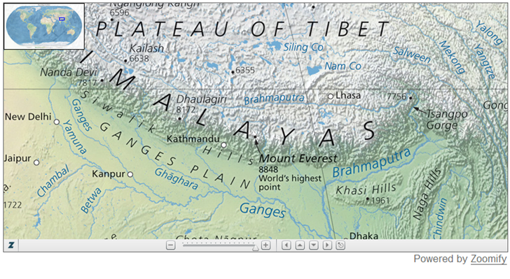
You can view the imagery online in a Zoomify interface, but as with his other imagery, he also provides free downloadable versions of this imagery in CMYK JPEG, and Adobe Illustrator files with the labels and graticule.
Via the always excellent Map Room.
Other posts in the Map Graphics series
- Downloadable Large-Format Historical Maps
- Online Map Collections
- Maps Of War
- Free Blank/Colored Map Graphics
- More Online Historic Maps
- Virtual Version Of The Field Museum’s Map Exhibit
- Animated US Civil War Maps
- List Of Libraries With Map Resources
- Historical Nautical And Civil War Maps
- Online Historical Atlas Of Canada
- High-Resolution Mexico Road Maps
- Physical Map Of The World
- Historic French Maps (17th-19th Century)
- Self-Colored Map Graphics
- Early-Twentieth-Century Austro-Hungarian Military Maps Of Central And Eastern Europe
- Online Articles From “The Map Collector”
- Free Outline Maps
- Free Vector Country Borders, Administrative Boundaries, And Soon More


0 Responses to “Physical Map Of The World”