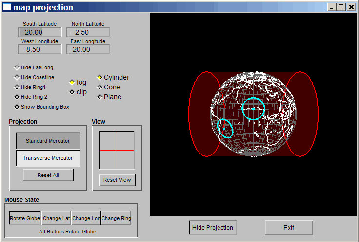
G.Projector, posted about earlier, only produces flat, non-interactive map projection images. map projection is a stand-alone map projection viewing program with interactive capabilities. It was written to demonstrate a concept called the “floating ring”, where you can move a circular figure about a globe and watch the change in its distortion in a map projection viewer – sort of a souped-up interactive version of Tissot’s Indicatrix. The program is available for Windows, Solaris, and IRIX; be sure to download the coastline data file as well, and put it in the same directory as the executable.
No installation, just run the program:

You can turn the displays on and off with the selector buttons, but the selectable items have a tendency to turn off by themselves when you change the display; just click on the button a few times, and they should come back. You can choose from only 5 projections: two cylindrical (Standard and Transverse Mercator), two conic (Lambert Conformal and polyconic), and polar stereographic.
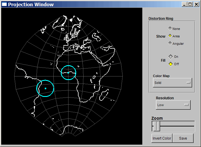
Using the the Mouse State buttons, you can modify the orientation of the projection surface relative to the globe, or move the globe relative to the projection. The Mouse State buttons control what the cursor does when you click and drag in the globe window. “Rotate Globe” is obvious, except that if the cursor is near a blue “floating ring”, it will drag it to another position. “Change Lat” and “Change Lon” let you move the projection surface around with the mouse, while “Change Ring” lets you move a ring (left button) or resize it (right button). The “View” section lets you change the angle at which you’re viewing the globe and projection (click and drag in the box). At any time, you can click on the “Hide(Show) Projection” button to see the Projection Window (it may take several clicks to get there):

The view in the “Projection Window” will automatically be updated as you change parameters in the main “map projection” window. So if you move the “floating rings”, or the projection surface, in the main window,you’ll see the changes in the projection window. Click on the “Save” button, and you can export the projection image in JPG format. “Resolution” sets the resolution of the continent outlines, but it’s reversed: “Low” is actually the highest resolution, and the only one actually worth using.
It’s a decent interactive program, marred mainly by the limited selection of projections, and occasional operational flakiness. Still, it’s the only stand-alone map projection viewer with true 3D capabilities I’ve found so far. Oddly enough, the online program Map Projections works a lot better, even if it doesn’t have the “floating ring”.