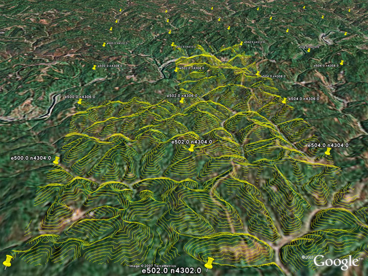
I’ve been meaning to write about these LIDAR Tools for a while, but since Google Earth Blog has just posted on their Google Earth visualization capabilities, I’ll jump in with my two cents. Posted by Martin Isenburg of the University of North Carolina – Chapel Hill, these tools allow quick conversion of LIDAR data into contour and DEM Google Earth KMZ files for “quick” basic visualization of the data. The process involves taking the original LIDAR data, simplifying it down a bit for contours, then converting it directly to either transparent contour overlays, or high-resolution DEM reflectance overlays. Here’s a screenshot of a set of contours from their showcase overlay gilmer.kmz (click on the image for a larger view):

Note: To see the contours for a grid square, you’ll have to click on the placemark icon for a square, then click on the “load contours” link in the info balloon that pops up.
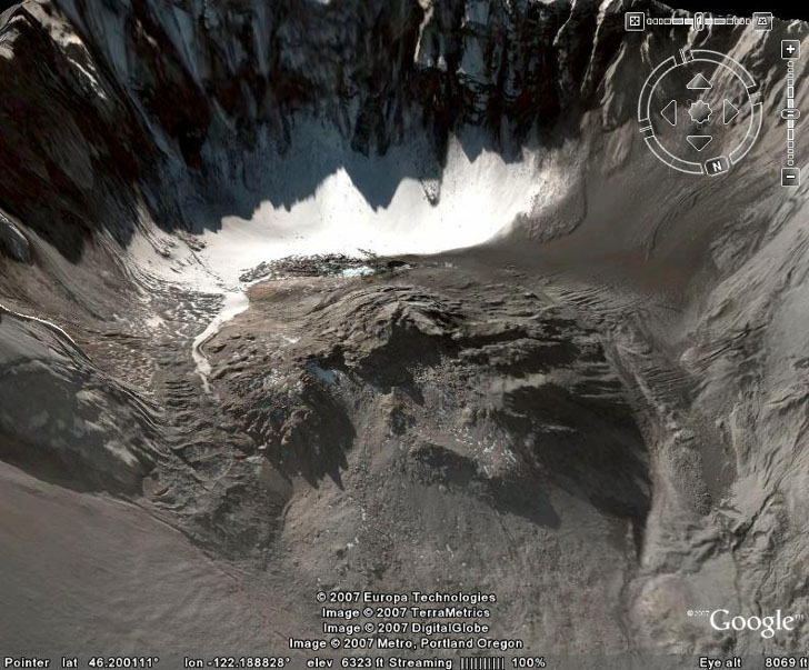
Here’s a screenshot of the interior of Mt. St. Helens from Google Earth:

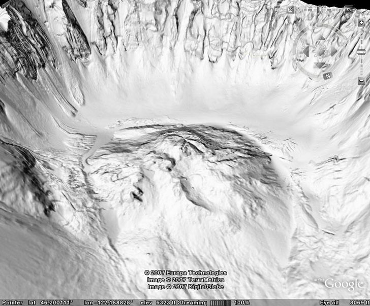
And here’s the same view with the high-resolution LIDAR DEM reflectance view loaded in from the saint_helens.kmz file:

All the tools used to create these overlays are downloadable from the website; they’re all command-line tools (ouch), but there’s an example of usage given to make figuring them out a bit easier.
Also available are a basic set of LIDAR tools to:
- Convert text ASCII LIDAR data to the more efficient LAS format
- Print the LIDAR data
- View the LIDAR data
- Compress it losslessly