In a previous post, I listed off a few sources of free .img maps that can be uploaded to a Garmin GPS unit; GPS Tracklog recently posted a few more as well. There’s a new site called GPS MapSearch that makes the process of locating these maps a lot easier, using a Google Maps interface. Click on a point in Google Maps, and a list of Garmin-compatible .img maps for that area will appear in the right text box:
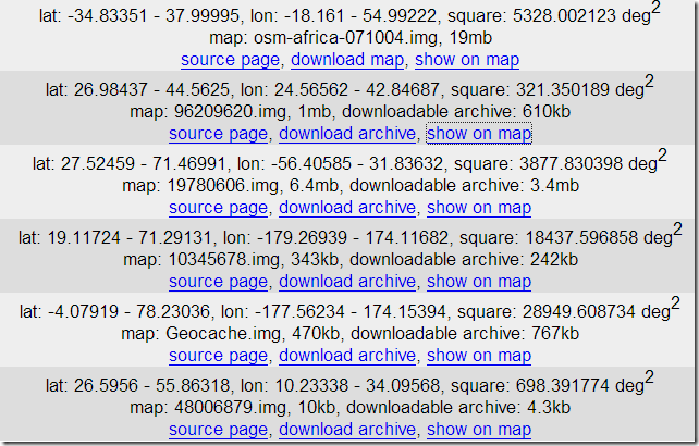
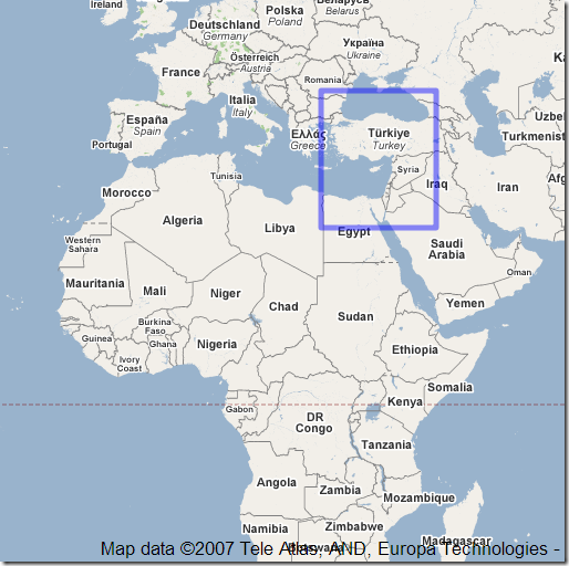
listing the geographic extents, with links to the original web page and the downloadable map file. Click on “show on map”, and the extents covered by that particular map will be displayed in the Google Maps interface:
Area coverage, level of detail, and quality of data are likely to vary widely, and it looks like some of the maps sources listed above aren’t included (the author is soliciting that data, so that may change). But it’s still a really nice tool to have, especially if you’re looking for Garmin .img maps in areas that aren’t covered by commercial products. Once you have a .img map, you can easily add it to your MapSource dropdown list using Mapset Toolkit.


there is a discription of how to use img files with mapsource and gps. oké it is in duth: http://www.gps-info.nl/custom_maps.html
The new name of the abovementioned site is http://gpsmapsearch.com
Thanks for the update – I’ve modified the name and link accordingly.