Two previous posts talked about the coordinate converters CorpsCon and GeoTrans. Both are very good, but are large in filesize, and not necessarily user-friendly. There are two other freeware coordinate converters that are smaller in download size (1.7 MB and 0.9 MB), and fairly easy to use for single point conversions.
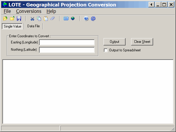
LOTE (Location On The Earth) lets you do both single point and batch text file conversions. Opening the program brings it up in single-point mode:

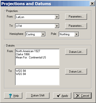
Set the input and output coordinate systems using the Conversions => Projections And Datums menu item or command button:

For single points, just enter the data, and press F9 or the Calculate button on the toolbar, and the converted coordinates will appear in the text box.
Click on the “Data File” tab to go to the data file input page. For data files, you’ll need to have them in either tab-delimited or comma-separated value formats. The first data column need to be either blank or unneeded, as LOTE has an annoying habit of overwriting that first data column on conversion with some unidentifiable parameter. And you will also need to have blank data columns in your text file for the converted coordinates as well. Open the files using the File => Open menu; the results will be saved in tab-delimited format. Overall, as big a pain to deal with as GeoTrans’ batch conversions
TatukGIS Coordinate Calculator only does single point conversions, not batch operations on text files. But it’s also smaller and easier to use than LOTE.
It currently supports 24 projections, and 225 datums, but the website says that Version 2.0 is coming soon, supporting:
- 125+ projections
- 350 datums
- 500 coordinate transformations (datum shifts)
- 50+ ellipsoids
- 57 unit types
- 1,800 coordinate systems (including U.S. State Planes and map grids)
- User defined coordinate systems based on WKT (OpenGIS) projection files.
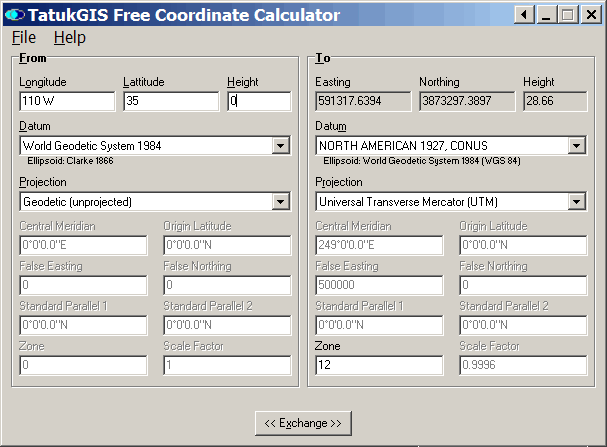
Conversions are a snap – just set your input and output coordinate systems, then enter the input coordinates into the appropriate boxes on the left:

Longitudes have to be entered with either +/- at the front or E/W at the end, and latitudes +/- or N/S in a similar fashion. The conversion will get done automatically as you type in the coordinates, and the program will let you know if your input isn’t formatted correctly. You can enter coordinates in decimal, or in degrees/minutes/seconds by putting a space between the numbers. The “Exchange” button at the bottom swaps the input/output coordinate systems selected.
Finally, if you have Microsoft Excel, the Ectrans converter is a VBA macro that converts spreadsheet coordinates in UTM to latitude/longitude and vice versa, and also decimal degrees to degrees-minutes-seconds and back again.