Here’s a few additional color applications that might prove a useful complement to the application Kuler (from yesterday’s post) in designing map color schemes.
An online color application: Name That Color. Select a color from the color wheel, and Name That Color will … name that color. Also gives you the RGB and hex numbers for it.
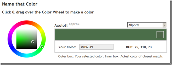
Open source; Javascript and php code available at the website.
Color Cop: A Window desktop application that lets you:
- Determine the color code for a color anywhere on your desktop
- Single-pixel sampling, or 3×3 and 5×5 averaging
- Automatically generates a 42-color palette of complementary colors for your select color
- And more …
Colorzilla: A Firefox extension that shows the color codes (RBG and hex) for the point under the cursor in the Firefox browser.
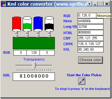
KML Color Converter: Mix and match R, G, B and black, set transparency, and get back the KML color code; gives other color codes as well (like RGB, CMY, CMYK, HSL). Also has a color picker to select colors from anywhere on-screen.
Color Palette Generator, Color Hunter: Online apps that create a color palette based on those found in a graphic or image file. You enter the URL of the image, and get back a palette with the colors in that image.
Check this out: http://colorusage.arc.nasa.gov/
A great website full of resources and tools for information graphics.
Thanks – that’s a great resource!