blankblank blank


Archive for the 'cartography' Category Page 4 of 14


Personal Web Maps With StepMaps

StepMap lets you create distinctive personalized maps that you can save as an image, or embed on a web page. A step-by-step wizard walks you through the process.

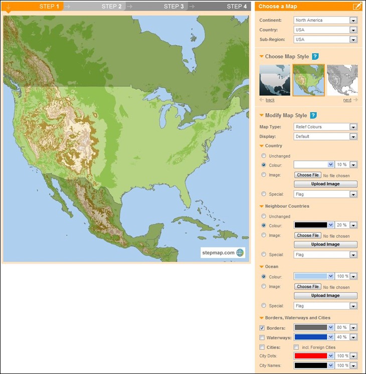
Step 1: Choose a preset region and map style, modify the style as you wish, or upload your own map:

stepmap1

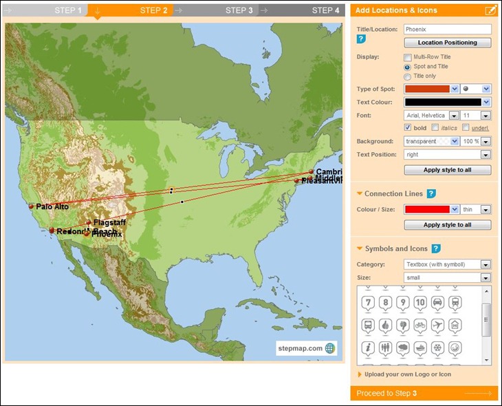
Step 2: Add points/icons, and connecting lines between points if you want. Click on the map to add a point; you don’t need to be exact in the positioning, as StepMap lets you automatically georeference the location based on its name.

stepmap2

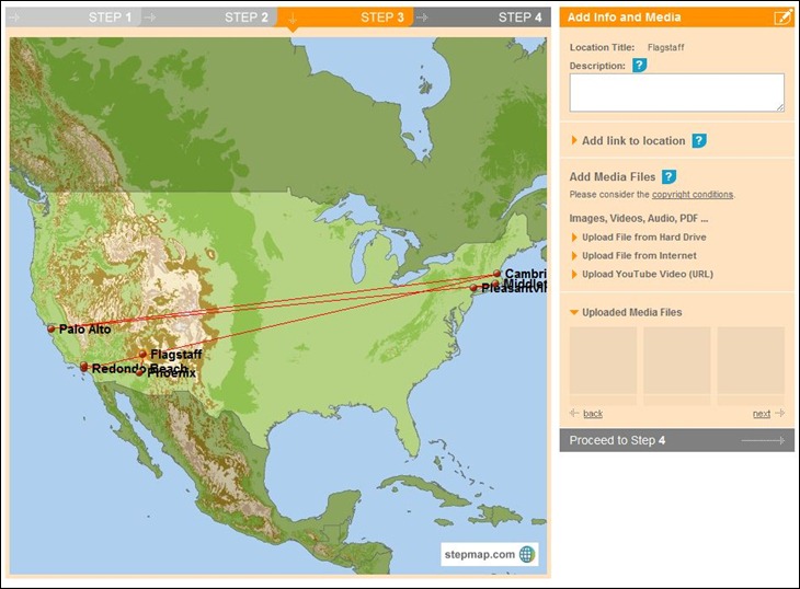
Step 3: You can optionally upload media files (picture, video, audio, documents) and link them to locations, or just link web addresses to them:

stepmap3

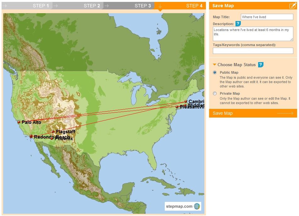
Step 4: Give the map a title//description/tags, then save it ( you have to add all three, even if you don’t want to):

stepmap4

Once saved, you can print out the map right away, save it as an image, link to a map page, or embed it on your website using provided HTML code:

Where I've lived
Create a Map with StepMap

StepMap

Where I've lived

One advantage of embedding the map code rather than just the image is that if you later modify the map, the changes will automatically be reflected in the embedded map.

Basic functionality is completely free for private, non-commercial and education use, and some commercial use is free as well; consult the Terms Of Use table to see what usage is allowed, and also what you can get by subscribing to the paid service.

Via La Cartoteca.


Desktop Earth: Dynamically-Updating Geographic Windows Wallpaper

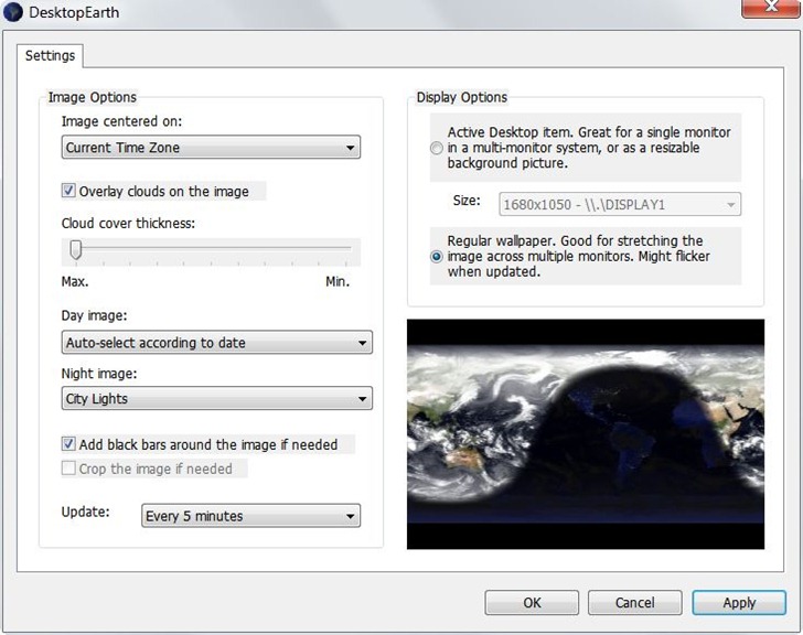
This is pretty cool! Desktop Earth is a geographic wallpaper background for Windows that:

  • Displays seasonal NASA Blue Marble Imagery, or a fixed Blue Marble image
  • Displays day/night regions; options for city light displays in the night regions
  • Gives you the option of overlaying current cloud imagery, with variable opacity
  • Set the center of the image to any time zone
  • Update interval for day/night from one minute to one hour

Control panel:

desktopearth

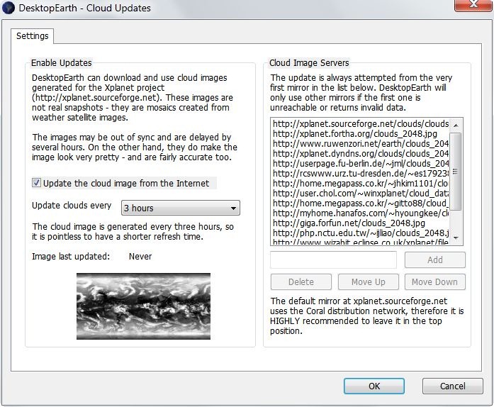
Cloud imagery is from the XPlanet project, and updates need to be specifically enabled (off by default):

cloudupdate

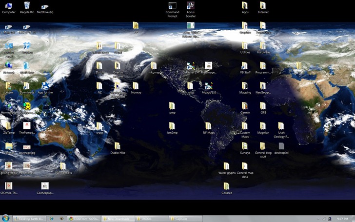
And how it looks on my desktop:

fulldesktop

If you’re not using Windows, you can use the Desktop Earth Online page to generate a static image that you can save to your computer and use as the wallpaper.

Via Lifehacker.


Historic Maps At The Maps ETC Site

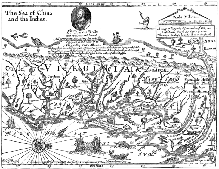
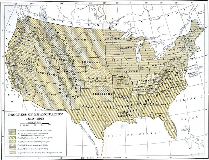
The University Of South Florida’s Educational Technology Clearinghouse runs the Maps ETC site, a collection of 5,000+ historic maps available in JPG/GIF and PDF formats; maps are also viewable in Zoomify windows (Flash interface to zoom in and out of map views). Maps are divided by continent, plus special sections for the United States and the world as a whole. According to the license, up to 25 maps can be used for non-commercial/education purposes; more than that, or commercial use, requires written permission. Although most of the original maps are out of copyright, ETC says they did a lot of cleanup work on them, thus converting them into derivative works under a new copyright; I’ll leave it to lawyers to parse that interpretation. As with any such collection, you may or may not find what you’re looking for, but it’s fun to look:

VA

emancipation

france


Map Projects From Stamen Design

Stamen Design is a “design and technology studio in San Francisco”, with a definite bias towards data visualization in general, and maps in particular. Found out that I’ve already covered one of their projects before, the Walking Papers project which lets you add data to the OpenStreetMap project with paper maps. But just poking around their list of projects a bit, I found:

Continue reading ‘Map Projects From Stamen Design’


Harvard Geospatial Library

The Harvard Geospatial Library is:

A collection of 6,871 worldwide and regional geographic data layers, scanned historic maps and associated descriptive information that can be searched mapped and downloaded for use for use with your GIS software.

A significant fraction of the data layers are listed as “Restricted” (e.g. ESRI data), meaning they can only be used by Harvard staff and students. Still, there’s a fair amount of freely-distributable data available, although it’s a pretty mixed bag of stuff. My attempts to use the Basic and Advanced search functions usually yielded few to no hits; better to click on the “Map Browse” tab and then pan/zoom the map to your area of interest; you’ll then get a list of up to 1000 datasets that are relevant to that area:

Continue reading ‘Harvard Geospatial Library’


Radical Cartography

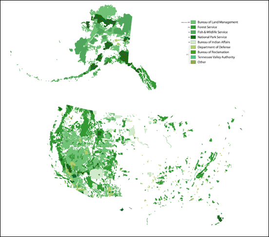
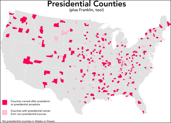
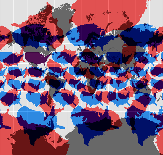
Via the Kelly Lab Blog: Radical Cartography has a terrific set of maps covering a wide variety of unusual topics and visualizations. These are just “thumbnails”; larger versions are available at the site:

Federal land in the US:

federalland

Counties named after US Presidents:

presidential_sm

How the US would look in the Mercator projection if it were located at different latitudes and longitudes:

wandering_merc_sm

… and lots more – browse away!


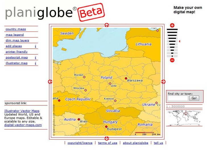
Basic Postscript And Illustrator Country Maps With Planiglobe

Planiglobe lets you select a country or world region, and then download a Postscript or Adobe Illustrator file with that data:

planiglobe

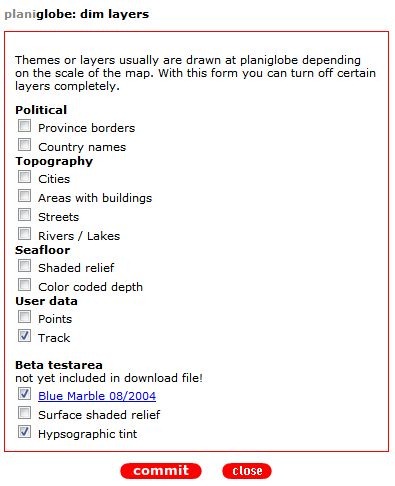
You have some control over layers displayed, though not that much:

planiglobelayers

Note that  you check a box to *not* show a layer; this really needs to be fixed. You should also make sure that pop-ups are enabled for this site, and be prepared to click a link several times to get it to work. I couldn’t get the “add places” function to work; this supposedly lets you add your own points to a map. It also appears as though the map is in geographic projection (Plate Carree), which introduces major distortions in shape even at the country level; I’d like to see this changed to Mercator.

But hey, it’s in beta, so I’m guessing it will get better. If you need vector maps in SVG or WMF format, D-Maps is a better choice, but if you need them in PS or AI format, you might give this a try.


The Oxford Concise New World Atlas

This blog skews heavily towards topics related to digital geography, but that doesn’t mean I don’t still kick it old-school on a regular basis. Apropos of that, just received a review copy of the newly-published Oxford New Concise World Atlas, Third Edition.

Don’t be fooled by the word “Concise” in the title to thinking that this is a pocket-sized reference with tiny little maps; this hardcover book is over 13” x 10” in size, and clocks in at a hefty 4.5 pounds in weight. It’s also a very high-quality printing job, color glossy printing bound in sewn signatures that will keep the pages from falling out after extended use. One really nice touch is that printing doesn’t extend all the way down into the binding area, so all the printed area is visible; I’ve owned atlases where some of the printing is lost in the crease where two pages meet. Another nice touch is the Table of Contents, which lists not just the maps but also a graphic thumbnail that shows the area they cover:
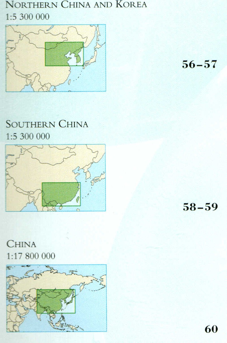
toc

Plus the book’s endpapers also show overviews of the world, with numbered boxes referring you to the map pages that cover those regions.

The part that impressed me the least was the 40+ pages dealing with topics like “The Constellations”, “Forces Of Nature”, “Languages And Religions”, “Energy And Minerals”, and so on. Each topic was two pages of mainly text, with a few stock photos and the occasional small map inset. Two pages simply isn’t enough to cover the topics in any reasonable detail, and I would have expected that an atlas would have featured far more thematic maps on these topics than it actually did. I hope that future editions focus more on how maps can illustrate and illuminate these topics better than text (“picture worth a thousand yada yada yadas”).

No complaints on the maps, though – expertly done, and jam-packed full of detail (and this is a crappy scan converted to a JPG; the real page looks far better):
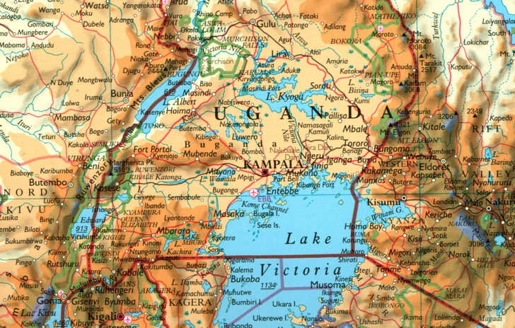
atlasmap

You might even complain that there’s too much detail, but even the large 10” x 13” size doesn’t leave a lot of room to fit in everything that you’d want in an atlas map. Maps show both physical and political geography, including continent-scale maps for context and country/region close-ups for greater detail. And the book winds up with a 94-page index (!)  that lists most of the geographic features on the maps keyed by page number and letter/number grid reference.

As with any maps, I wish they were bigger ;-); but that would make the book both far more expensive and more cumbersome to handle. As is, at about $27 from Amazon, this atlas is a screaming deal, cheaper than most bestsellers. Every reference shelf needs an atlas, and this one’s got a spot on mine.

Oxford University Press has many other atlases available for sale on a wide range of topics, at prices that range from very reasonable to mildly insane ($360 for the Formae Orbis Antiqui).